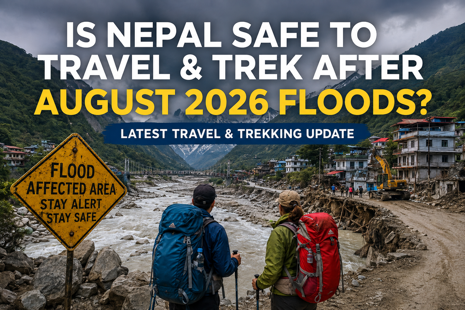
Is Nepal Safe to Travel and Trek After the August 2026 Floods? Latest Travel & Trekking Update

Introduction

Last Updated: August 31, 2026

The devastating flash floods that struck parts of Nepal on August 26, 2026, have raised understandable concerns among travelers planning holidays, trekking trips and mountain adventures. Images of damaged roads, bridges, settlements and river corridors have led many people to ask an important question: Is Nepal safe to travel and trek after the August 2026 floods? The short answer is that Nepal should not be considered unsafe as a whole simply because some areas have been severely affected. The situation is highly location-specific. Rasuwa and parts of the Bhote Koshi and Trishuli river corridors have suffered major damage, while Nepal’s tourism destinations are spread across a large and geographically diverse country.

However, the situation is still developing. Rescue, recovery, road repairs and assessments are continuing in the affected areas. Travelers should therefore check the latest conditions for their specific destination and trekking route before departure. This guide explains the Nepal floods of 2026, the current travel situation, trekking safety considerations, affected regions and what travelers should know before visiting Nepal.

Important Travel Update: Conditions following the August 2026 floods are changing. Travelers should confirm current road, trail, weather and transportation conditions for their specific destination before departure.

Is Nepal Safe to Travel After the August 2026 Floods?

Nepal remains a large and geographically diverse destination, and the August floods did not affect every tourist destination in the country in the same way. The most serious impacts were concentrated along river corridors in parts of central Nepal, particularly around Rasuwa, Nuwakot, Dhading, Gorkha, Chitwan and Tanahun. The World Health Organization reported that the government declared 15 municipalities in affected districts as disaster crisis-affected areas for three months.

For travelers, this means that safety needs to be assessed according to the destination and route, rather than treating the entire country as one affected zone. If your itinerary passes through a flood-affected road corridor, bridge or trekking gateway, conditions may change quickly. Alternative routes, delays or postponements may be necessary while infrastructure is repaired.

Current Nepal Travel Situation

Nepal’s tourism and aviation infrastructure continues to operate, and official immigration information at Tribhuvan International Airport shows ongoing international passenger activity after the floods. At the same time, some roads and infrastructure in disaster-affected areas have been seriously damaged. The Nepal Tourism Board reported that tourists were among those affected in the Rasuwa area, while roads and bridges around Timure and Syafrubesi were damaged. Travelers should therefore distinguish between arriving in Nepal and traveling to a particular flood-affected area. The two are not necessarily the same.

Which Areas Were Affected by the Floods?

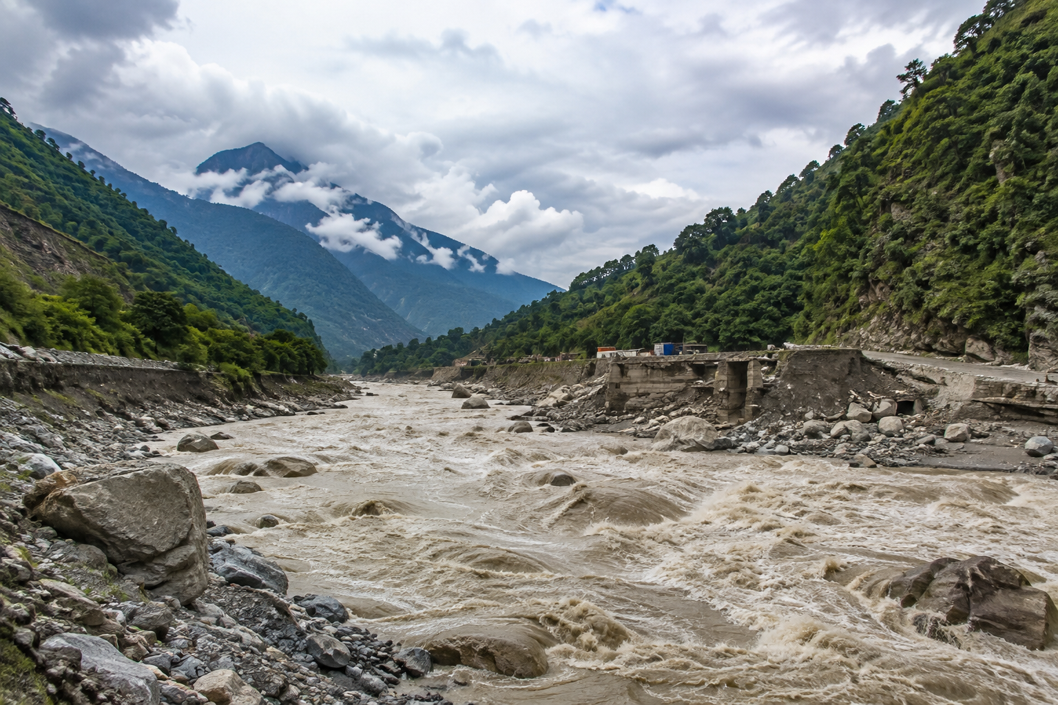
According to the WHO’s initial assessment, the August 26 flash floods affected communities along the Bhote Koshi and Trishuli river corridors, including areas of Rasuwa, Nuwakot, Dhading and Chitwan, as well as Gorkha and Tanahun in Gandaki Province. Rasuwa was among the most severely affected areas. The disaster caused extensive damage to settlements, roads, bridges, power infrastructure and other facilities around the Bhote Koshi corridor. Because the situation remains fluid, travelers should avoid assuming that a road or route is open simply because it was operating normally before the disaster.

What Happened During the Nepal Floods in August 2026?

On August 26, 2026, a sudden and destructive flood struck the Nepal-Tibet border region. Initial reporting linked the event to an ice-rock or glacial collapse and temporary blockage in the upper Lhende River system. The resulting surge moved rapidly into the Bhote Koshi corridor and downstream river systems. The disaster developed extremely quickly, leaving communities and travelers with very little time to respond.

Major Flood-Affected Areas

Rasuwa was at the center of the disaster, particularly around the northern border and Bhote Koshi corridor. Floodwaters and debris then affected downstream areas connected to the Trishuli river system. The WHO has identified affected areas in Rasuwa, Nuwakot, Dhading, Chitwan, Gorkha and Tanahun.

Damage to Roads, Bridges and Infrastructure

The floods caused extensive destruction to transportation and other infrastructure. Reports have described damage to roads, bridges, settlements, electricity infrastructure and hydropower facilities. This is particularly important for travelers because Nepal’s trekking routes often depend on mountain roads to reach trailheads. A trekking trail itself may remain intact while the road leading to the trailhead is temporarily unusable. For this reason, road access should be checked separately from trail conditions before starting a trek.

Impact on Local Communities and Tourism

The disaster has had a serious human and economic impact. Rescue operations have involved Nepal’s security forces, local authorities, humanitarian organizations and international support teams. The tourism sector has also been directly affected, particularly because the Rasuwa corridor is connected to trekking and pilgrimage travel. The Nepal Tourism Board reported hundreds of tourists initially losing contact in the affected area, including foreign and Nepali travelers. As recovery continues, the priority remains the safety of affected communities and the search for missing people.

Nepal Travel Update: Are Tourist Destinations Open?

Nepal has many different tourism regions, and conditions should be checked individually rather than making a single judgment about the entire country.

Kathmandu, Pokhara, Chitwan and Lumbini

These destinations are geographically separate from the main Rasuwa disaster corridor, although downstream areas such as Chitwan have also been involved in the wider flood response. Kathmandu remains Nepal’s main international gateway, and official airport immigration records show continued passenger processing after the disaster. Travelers visiting Kathmandu should nevertheless remain alert to weather-related road disruptions, especially during the monsoon season. Pokhara, Lumbini and other destinations should likewise be assessed according to current local road and weather conditions rather than based solely on news from Rasuwa.

Everest and Annapurna Regions

The Everest and Annapurna regions are geographically separate from the main Rasuwa-Bhote Koshi disaster corridor. This does not mean that trekking conditions can be guaranteed without checking. Mountain weather, landslides and transportation disruptions can occur independently of the August flood event. Travelers planning Everest or Annapurna treks should therefore confirm current flight, road, trail and weather conditions immediately before departure.

Is Nepal Safe for Trekking After the Floods?

Nepal trekking is still possible, but route-specific safety checks are essential. The August floods mainly affected particular river corridors and infrastructure rather than every Himalayan trekking route. However, the monsoon season itself brings additional risks, including landslides, swollen rivers, slippery trails and road blockages. A trek that is geographically far from the flood zone may have very different conditions from a trek whose access road passes through an affected district.

Trekking Trail and Road Conditions

One of the most important lessons after the floods is that trail condition and road condition are not the same thing. A trekking route may be physically intact while the road used to reach its starting point has been damaged. Conversely, a road may be open while a particular section of trail has suffered a landslide.

Before departure, trekkers should confirm:

  • Access roads to the trailhead
  • Bridges and river crossings
  • Current trail conditions
  • Availability of teahouses
  • Weather forecasts
  • Local authority notices
  • Transportation arrangements

Weather, Landslides and Mountain Safety

The August floods occurred during Nepal’s monsoon season, when heavy rainfall can increase the risk of landslides and flooding Even after floodwaters recede, unstable slopes and damaged bridges can remain dangerous. Travelers should not enter recently affected areas simply because water levels appear lower. For high-altitude trekking, weather can also change rapidly. Proper equipment, experienced guides and flexible itineraries remain important.

Nepal Trekking Safety: What Trekkers Should Know

Check Current Route Conditions

Do not rely only on information published several weeks or months earlier. Ask your trekking agency, guide or local authorities about the current condition of your exact route.

Travel With an Experienced Guide

A knowledgeable local guide can monitor changing conditions, identify alternative routes and communicate with local communities. Nepal Tourism Board also maintains Tourist Police posts in major tourist areas, including Lukla, Pokhara, Chitwan, Rasuwa and other trekking destinations.

Prepare for Changing Weather

During the monsoon and transition periods, weather can affect roads, flights and mountain trails with little warning. Allow extra time in your itinerary rather than scheduling important international connections immediately after a mountain journey.

Get Travel Insurance

Travel insurance is particularly important for trekking in Nepal. Your policy should cover the activities and altitude involved in your itinerary and provide appropriate emergency assistance. For remote or high-altitude routes, travelers should understand the conditions of their evacuation coverage before beginning the trek.

Is Everest Base Camp Trek Safe After the Floods?

The Everest Base Camp Trek is located in the Khumbu region, far from the main Rasuwa-Bhote Koshi flood corridor. The August floods therefore should not automatically be interpreted as meaning that the Everest Base Camp route has been destroyed or closed. However, Everest travel involves flights or road connections to the trek’s starting point, and mountain weather can cause separate disruptions.

Everest Region and Lukla Update

Travelers heading to Everest should confirm the status of their Kathmandu–Lukla flight, alternative road or air arrangements, trail conditions and weather forecast close to departure. If conditions change, a good trekking operator should be able to adjust transportation and itinerary plans.

Is Annapurna Trekking Safe After the Floods?

The Annapurna region is also separate from the main Rasuwa disaster area. Popular routes such as the Annapurna Circuit, Annapurna Base Camp and Mardi Himal Trek have their own transportation and weather considerations. Travelers should therefore evaluate the specific route rather than assuming that conditions in central Nepal apply equally to the Annapurna region.

Annapurna Region and Access Update

Before beginning an Annapurna trek, check:

  • Road access from Kathmandu or Pokhara
  • Conditions at the trailhead
  • Current rainfall and landslide warnings
  • Trail and bridge conditions
  • Accommodation availability
  • Local guidance

This is especially important during periods of heavy rain.

What About Other Trekking Regions?

Nepal’s trekking network extends far beyond Rasuwa.

Langtang, Manaslu, Mustang and Dolpo

The Langtang and Gosaikunda areas require particular attention because Rasuwa was one of the districts directly affected by the August floods. The Nepal Tourism Board identifies Gosainkunda as part of the Langtang trekking area, and access has historically involved roads through Rasuwa. Travelers planning Langtang or Gosaikunda should therefore obtain the latest access and trail information before traveling. Manaslu, Mustang and Dolpo are geographically different trekking regions, but each has its own road, weather and trail considerations. Current conditions should always be confirmed for the exact itinerary.

Should You Cancel Your Nepal Trip?

The answer depends on where you are going, when you are traveling and how your route is affected. A traveler visiting Kathmandu, Pokhara or another destination that is operating normally does not necessarily face the same situation as someone planning to travel directly through the flood-affected Rasuwa corridor.

When to Consider Postponing

Consider postponing or changing your itinerary if:

  • Your route passes through a disaster-affected area
  • The access road or bridge is damaged
  • Local authorities advise against travel
  • Severe weather is continuing
  • Your trekking agency cannot confirm safe access
  • Your insurance or emergency arrangements are inadequate

When You Can Continue Your Trip

If your destination and trekking route have been checked and confirmed operational, you may be able to continue your Nepal journey with appropriate precautions. Keep your itinerary flexible and allow additional time for transportation.

How to Travel Safely in Nepal After the Floods

Check Official Updates

Conditions can change quickly during disaster recovery. Check information from the Nepal Tourism Board, local authorities, your embassy and your trekking agency before traveling.

Keep Your Itinerary Flexible

Avoid creating a schedule with no extra time between trekking, domestic flights and international departures.

Follow Local Safety Advice

If authorities, guides or local communities advise travelers to avoid a road, bridge, river crossing or trail, follow that advice.

Carry Essential Emergency Information

Keep your passport, insurance information, emergency contacts and important travel documents accessible. Nepal Tourism Board lists 1144 as the Tourist Police toll-free hotline, while police assistance can be reached at 100.

Nepal Tourism Update 2026: What Travelers Can Expect

Nepal’s tourism industry has faced a major shock in the areas directly affected by the floods, particularly in communities dependent on transportation, trekking, pilgrimage and cross-border trade. Recovery will take time. Roads, bridges, hydropower infrastructure and local facilities in the affected corridors need assessment and reconstruction. At the same time, Nepal’s tourism geography is much larger than the affected flood zone. Travelers should therefore avoid judging every trekking region based on conditions in one district. The coming weeks are likely to remain important for monitoring road repairs, trail assessments and weather conditions.

Frequently Asked Questions

Is Nepal safe to travel after the August 2026 floods?

Nepal is not uniformly affected by the floods. Some districts suffered severe damage, while other tourism destinations are geographically separate. Travelers should check the latest conditions for their specific destination before departure.

Is Nepal safe for trekking in 2026?

Trekking remains possible in Nepal, but safety depends on the region, route, weather and access conditions. Routes affected by flooding, landslides or damaged infrastructure require additional caution.

Which areas of Nepal were affected by the August 2026 floods?

Initial assessments identified significant impacts in Rasuwa, Nuwakot, Dhading, Chitwan, Gorkha and Tanahun.

Is Everest Base Camp Trek safe after the floods?

The Everest region is geographically separate from the main Rasuwa-Bhote Koshi flood corridor. Nevertheless, trekkers should check current flight, trail and weather conditions before departure.

Is Annapurna Base Camp Trek safe?

The Annapurna region was not the main focus of the August flood disaster. However, monsoon-related landslides and road conditions can still affect travel, so current local information should be checked.

Are roads in Nepal safe after the floods?

Road conditions vary considerably. Some roads in affected districts have suffered serious damage, while roads elsewhere may be operating normally. Always confirm the condition of your specific route.

Is Kathmandu safe for tourists?

Kathmandu is outside the main Rasuwa flood corridor and remains Nepal’s principal international gateway. Travelers should still monitor weather and local transportation conditions.

Should I cancel my Nepal trekking trip?

Not necessarily. The decision should depend on your specific trekking region and current route conditions. If your route passes through a seriously affected area, postponing or changing the itinerary may be appropriate.

When is the best time to trek in Nepal after the floods?

The best timing depends on the recovery of individual routes as well as seasonal weather. Travelers should prioritize current route assessments rather than relying only on the calendar.

Is Nepal open for tourists after the August 2026 floods?

Yes, Nepal remains open to international travelers, but conditions vary by destination. Travelers should check current road, trekking route, weather and transportation updates before starting their journey.

Is it safe to visit Nepal during the monsoon season?

Travel during the monsoon season can be possible, but heavy rainfall may increase the risk of landslides, flooding, road disruptions and flight delays in some areas. Travelers should check current weather and route conditions before departure.

Is Nepal Safe for International Travelers After the August 2026 Floods?

Yes, international travelers can still visit Nepal, but conditions may vary by destination following the August 2026 floods. Major tourist areas and trekking regions may remain accessible, while some roads, bridges, and local routes could experience temporary disruptions.

Conclusion: Is Nepal Safe to Travel and Trek After the August 2026 Floods?

Nepal remains open to travelers, but conditions vary by region. The August 2026 floods caused serious damage in parts of central Nepal, particularly around Rasuwa and the Bhote Koshi–Trishuli corridors, while many other tourist and trekking destinations remain separate from the most affected areas.

If you are planning to travel or trek in Nepal, check the latest road, trail, weather and transportation conditions for your specific destination before departure. Travelers heading toward affected areas should remain flexible and be prepared for route changes or delays. With proper planning, updated local information and responsible travel decisions, visitors can continue to explore Nepal while supporting communities recovering from the disaster.

Planning a trek or adventure in Nepal? Contact Best Trek & Adventure to check your route and plan your journey with local support.
Nepal Flash Floods 2026: Latest Travel, Safety & Tourism Update

Last Updated: August 27, 2026

 Note: This is a developing disaster. Rescue teams are still searching for missing people, damage assessments are continuing, and casualty figures may change as authorities verify information. This article uses information available from Nepalese authorities, scientific organizations, humanitarian agencies and international news agencies and will be updated as reliable new information becomes available.

Nepal Flash Floods 2026: What Happened?

sudden and very destructive flash flood hit the Nepal–China border area on August 26 2026 sending a big wave of water, mud, rocks and debris through northern Nepal. The biggest damage happened in Rasuwa District around Rasuwagadhi, Timure and the Syabrubesi area. The flood then moved down the Bhote Koshi and Trishuli river systems affecting people and buildings south. According to the International Centre for Integrated Mountain Development (ICIMOD) water levels in the Trishuli River went up fast.

At Galchchi the river reportedly rose by much as nine meters in about 30 minutes while the level at Malekhu increased by around seven meters over a similar time. The speed of the rise helps explain why people living and working close to the river had little time to react. The event was much more than a monsoon flood. A large amount of water and debris moved through a Himalayan river area carrying boulders and other things capable of destroying bridges, roads, buildings and river-side structures.


What Caused the Massive Flash Flood?

The exact cause is still being looked into. Current evidence suggests a major ice-and-rock event in the high Himalayan area near the Nepal–China border. ICIMOD says scientists are looking into an ice-rock avalanche from a high-altitude area as the suspected trigger. Early analysis suggests that a large amount of ice and rock may have entered the Lhende Khola, a tributary of the Bhote Koshi River creating a surge of water, sediment and boulders downstream. Reuters has reported that satellite images and expert analysis show the collapse of part of a glacier, with ice and rock falling into the valley and causing the destructive flow.

There is also evidence that debris may have blocked a part of the river. If water built up behind such a blockage and the blockage then failed it could have caused an extra surge downstream. ICIMOD says researchers are still checking the size and stability of any blockage. The IFRC has described the event as a glacial-lake-outburst flood from the Xizang/Tibet area near the border. Because scientific study is still happening it is better to not say it was one thing before all the facts are known.

Was an earthquake the cause?

An earthquake was one of the ideas because unusual shaking was recorded around the time of the disaster. However current analysis shows the movement and collapse of ice and rock than a regular earthquake directly causing the flood. Reuters reported that experts and USGS analysis linked the shaking to the collapse and debris flow. ICIMOD meanwhile has said that researchers are still looking at the data and have not found a direct link between the shaking and the flood. For now the best conclusion is that a major ice-and-rock or glacial collapse caused the big river surge while scientists keep looking for the story.


How Destructive Was the Flood?

The level of damage became clearer as rescue teams reached the areas. In Rasuwa the flood swept through homes and buildings along the river. Roads and bridges were broken or destroyed buildings were washed away. Important structures like hydropower facilities were affected. The IFRC reported damage to homes, roads, bridges, hydropower facilities and other important places with several bridges gone and some areas in Rasuwa very hard to get to.

The destruction also reached downstream. ICIMOD reported damage to monitoring stations along the Trishuli River while the very quick rise in water levels worried people living farther down. The disaster therefore affected more than the immediate flood area. It caused problems with transportation, power, communication, trade and access for communities that rely on the river corridor.


Deaths, Missing People and the Current Situation

The number of people affected is still being worked out.

By August 27 international reports said than 1,000 people were missing across Nepal and Chinas Tibet area with Reuters later saying the total was close to 1,500. Nepal had said than 826 people were missing while Tibet authorities said 558 were missing. The number of confirmed deaths has also changed as bodies have been found and identified. Reuters said at 165 people had died in its August 27 report while other reports have had different numbers as rescue and recovery continue.

These numbers should be seen as changing, not final. The high number of people missing is because of the people in the area. The corridor is used by people, workers, traders and foreigners including pilgrims going to Mount Kailash and Lake Manasarovar. Reuters said foreign nationals from countries were among those missing. Because of this Nepals authorities and embassies are still checking names and places not just relying on reports.


From Tibet to Rasuwa: How the Flood Spread

Understanding the geography helps explain the size of the disaster.

The suspected cause happened in the Himalayan area on the Tibet/China side of the border. From there the sudden wave entered the river system connected to the Lhende Khola. The water and debris then reached the Rasuwagadhi border area in Nepal. Moved through the Rasuwa area, including Timure and Syabrubesi. From the Bhote Koshi system the flood continued toward the Trishuli River making the effects reach farther downstream. ICIMOD warned of impacts reaching Nuwakot and Dhading. Noted very fast changes in water levels. This is why the disaster cannot be seen as a Rasuwa flood. The river connected the high-mountain event to communities downstream.


Impact on the Nepal–China Border

The disaster has had an effect on the Nepal–China border area, especially around Rasuwagadhi and the area on the Tibetan side. Rasuwagadhi is more than a place. It is a border point for trade, transport and travel between Nepal and Tibet. Damage to roads, bridges, power systems and other things has affected both people and movement across the border.

On the side authorities reported serious damage around Gyirong County including broken structures and people being moved out of dangerous areas. Reuters said Chinese officials were also watching a lake because of the risk of another flood. The cross-border nature of the disaster means that cooperation between Nepal and China is very important for river monitoring, early warnings, search and rescue and handling possible extra dangers.


Rescue and Relief Operations

Search and rescue started away but broken roads, destroyed bridges, bad weather and difficult mountain area made it hard to get in. Nepal has used the Nepal Army, Nepal Police, Armed Police Force and disaster-management groups with helicopters being used to reach places that are cut off and search for missing people. Reuters said than 5,000 security workers were involved in the search and rescue and that more than 100 people had been saved by helicopter missions. The International Federation of Red Cross and Red Crescent Societies (IFRC) gave nearly CHF 1 million from its emergency fund to help the Nepal Red Cross Society with its work.

The money is meant to help provide help while teams check damage and find communities that need help. The United Nations has also said that humanitarian groups are helping the Nepal government. WHO teams have been sent with supplies while the World Food Programme, UNICEF and other groups are preparing or giving more help. On the side emergency and rescue teams have also been used and officials are checking the upstream area for more danger.


What Happens Next?

Finding missing people and helping those who survived are the important tasks right now. At the time authorities have to deal with a much longer recovery. Roads and bridges will need to be checked and fixed, electricity and communication systems restored damaged hydropower plants looked at and affected communities supported. There is also worry about flooding. ICIMOD has warned that if debris made a temporary blockage upstream, a sudden release of stored water could cause another flood. Officials and scientists are still watching the situation. This means that even though the main flood has passed the emergency is not over.


What Does This Tell Us About Himalayan Flood Risk?

The disaster has also brought attention to the changing risks in the Himalayan area. Glaciers, snow, frozen ground and mountain slopes are changing across the Hindu Kush Himalaya. These changes can affect the stability of high-altitude areas. However ICIMOD has said it is too early to say how much climate change played a role in this specific flood. That difference matters. A hotter climate can increase some glacier and mountain-related dangers. It would be wrong to say climate change alone caused this event. The disaster does however show the need for monitoring, more warning systems and more cooperation between countries that share Himalayan rivers.


Safety Advice for People in Nepal

Anyone near the river areas should follow what local authorities say and avoid going into damaged areas. Do not go near rivers to take pictures try to cross bridges or travel on roads that are closed. Water can rise quickly. Roads or bridge foundations might be broken underneath. Travelers should also check weather and river info. Nepals Department of Hydrology and Meteorology (DHM) gives live water data and flood info. It currently advises people to use its warning services when there is heavy weather. For tourists needing help the Nepal Tourism Boards Tourist Police helps in places, including Syafrubesi in Rasuwa.


What Does the Flood Mean for Trekking in Nepal?

The disaster should not be understood as meaning that every place for hiking in Nepal has been harmed in the way. The biggest problems are found near Rasuwa, the Nepal China border and the Bhote Koshi Trishuli area. However the situation is very important for people who want to do the Langtang Valley Trek because Syabrubesi is an entrance to the Langtang area. Any person planning to go through Rasuwa should look at the road and path conditions before they leave and be ready for changes in the route.

Other big places for hiking, such as Everest, Annapurna and Mardi Himal are away from the main area where the disaster happened. That does not get rid of the dangers from rainy season weather, landslides and road problems but people who are traveling should look at each place separately instead of thinking that conditions in Rasuwa are the same for all of Nepal.


Nepal Tourism Update: What Travelers Need to Know

The flood has clearly hurt tourism in the area that was directly hit. People from countries and those who were visiting for religious reasons were among those who were missing. The damage to roads and the border structures will make it hard to go through the Rasuwa area. For people who are thinking about visiting Nepal the problem is more about areas than the whole country. The best way is to look at the place and the road you are taking instead of just asking if Nepal is open. A person going to Rasuwa or the Nepal China border needs details than someone going to Pokhara, the Annapurna area or some other part of the country.

Before you travel check road conditions, transport times and hiking access with your airline, transport company, hotel, guide or local tour company. Travelers should also look at what their government says about traveling and make sure their insurance covers the activities they plan to do. At Best Trek & Adventure our advice is simple: safety and true information should come before any travel plans. If a path is broken or officials say not to go travelers should be ready to change or wait on that part of their trip.


Frequently Asked Questions

What caused the Nepal flash flood in August 2026?

Current scientific assessments point to a major ice-and-rock or glacial collapse in the high Himalayan region near the Nepal–China border. Scientists are still investigating the exact sequence that produced the sudden flood surge.

Which areas were most affected?

Rasuwa, particularly the Rasuwagadhi, Timure and Syabrubesi corridor, was among the worst affected. The flood then traveled through the Bhote Koshi and Trishuli river systems, with impacts farther downstream.

Did the flood affect China?

Yes. The event also caused major damage and casualties in Tibet’s Gyirong area and affected infrastructure on both sides of the Nepal–China border.

How many people died?

The confirmed death toll has been changing as rescue teams recover and identify victims. Reuters reported at least 165 deaths in its August 27 update. Because recovery operations are continuing, this should not be treated as the final toll.

How many people are missing?

The number is still being verified. Reuters reported nearly 1,500 people missing across Nepal and China’s Tibet region, including more than 700 foreign nationals.

Is Langtang Trek affected?

The Rasuwa access corridor has been seriously affected, so travelers planning the Langtang trek should check current road and trail conditions before departure.

Is Nepal safe for tourists?

The entire country is not uniformly affected by the flood. The greatest concern is travel through the directly affected Rasuwa, Bhote Koshi and downstream corridors. Conditions should be assessed destination by destination.

Can tourists still travel to Nepal?

Travel may still be possible in areas outside the affected corridors, but travelers should check current transportation, weather and local conditions before departure and remain flexible about their itinerary.


Latest Update — August 27, 2026

The search for missing people and the checking of damage are still happening after the flood on August 26. The recent international news says that the disaster has hurt both Nepal and Tibet in China with many deaths and a very big number of people still missing. Teams are still. Officials are watching for more floods from unstable piles and blocked rivers. Scientists are also still looking at how the ice and rock fall up in the mountains turned into such a big flood. ICIMODs current thinking is that an ice and rock fall is the start but the exact reason is still being looked into.

This article will be updated as verified information from authorities, scientists and humanitarian organizations becomes available.


Sources & Official Information

This article has been prepared using information from Nepalese and international authorities, scientific organizations, humanitarian agencies and established international news reporting. Because this is a developing disaster, readers should check the latest updates directly from these organizations:

Best Time To Travel and Trek in Nepal by Month & Season

Nepal, Known for its Himalayas, ancient heritage cities, varied cultures and trekking through the world’s greatest trail, is a year-round invitation for travellers. However, determining the best time to travel or trek to Nepal entirely depends on what you are after: clear mountain views, festivals, wildlife safaris, budget travels, or straightforward trails.

Nepal’s seasons can have an extreme influence on landscapes, temperatures, and visibility, which can widely vary your trekking experience from month to month. This comprehensive review goes in-depth about the major trekking seasons, meteorological patterns, monthly conditions, and much to expect in order to smooth the planning of your perfect Nepal expedition.

What Factors Determine the Best Time to Trek in Nepal?

Choosing your best time to trek in Nepal is not just about clicking on a month on the calendar; it’s about understanding how climate, terrain, weather patterns, and personal preference feed into the trekking experience. Below are the major factors that influence determining which trekking season suits you best:

1. Weather and Climate Conditions

The weather is the single most important factor when choosing your trekking month. Nepal’s mountains experience dramatic weather shifts depending on the season.

  • Autumn: Stable, clear, dry
  • Spring: Mild, warm, vibrant
  • Monsoon: Wet, cloudy, humid
  • Winter: Cold, dry, crisp

The best months to enjoy trekking activities are those marked by clear skies and stable temperatures.

2. Visibility & Mountain Views

Visibility directly influences one’s satisfaction with a trek; the clearer the day, the more spectacular the views of the Himalaya, with clouds in the grey months (June to August) can hide, screening those peaks.

  • Best visibility: October, November, March, and April
  • Lowest visibility: July, August

For photographers and first-time trekkers, visibility is a crucial factor..

3. Temperature Variations by Altitude

There can be enormous differences in temperature within a single trek due to the variable altitudes of Nepal, ranging from 1,000 m in valleys to passes at elevations of over 5,500 m.

Lower Altitude→ warm and humid

Higher Altitude → cold, windy, freezing at night

This has implications for gear to be taken and adds to the impression of difficulty on any trek.

4 . Rainfall & Snowfall Patterns

Rain and snow have a far-reaching bearing on trail safety and accessibility:

  • Monsoon rains can cause landslides and slippery trails.
  • Winter’s snow can completely obstruct the main passes (Thorong La, Cho La, and Larke La).
  • Autumn & Spring enjoy minimal precipitation.

Knowing about seasonal precipitation will help choose safe trekking routes..

5. Trail Conditions & Accessibility

Trail condition changes with the seasons:

  • Autumn: Dry, stable, comfortable 
  • Spring: Melting snow in high altitudes, muddy lower trails.
  • Monsoon: Slippery, leech-prone, risk zones.
  • Winter: Icy, snowy, fewer open high passes

Weather stability directly affects trekking safety and comfort.

6. Flights Reliability (Especially Lukla & Jomsom)

Certain trekking regions require domestic flights, which are highly weather-dependent:

  • Lukla (Everest region) 
  • Jomsom (Mustang/Annapurna)
  • Phaplu/Salleri 
  • Simikot (Humla) 

Most reliable months: Autumn & Spring

Highest cancellation rate: Monsoon & Winter

If your trek starts with a flight, seasons become even more significant.

7. Budget Considerations

Prices change dramatically depending on the month:

  • Peak season (high cost): Autumn & Spring
  • Off-season (budget-friendly): Monsoon & Winter

In off-season months, accommodation and flights can be up to 20–40% cheaper.

8 . Safety & Health Factors

Issues concerning altitude and weather posing hazards differ with time:

  • Altitude Sickness: Maximum risk in cold, dry months
  • Landslides/road blockages: Higher risk in the monsoon
  • Slippery ice & snow: winter
  • Heat exhaustion: Early summer

Picking the right season can help minimize these risks along the way.

Best Time for Trekking Plans in Nepal

Nepal has four distinct seasons, each with its own charm and challenges:

  • Spring (March-May)
  • Summer/Monsoon (June-August)
  • Autumn (September-November)
  • Winter(December-February)

Autumn and Spring are the best trekking seasons that provide different privileges across the breadth of the seasons.

Seasonal Guide to Trekking in Nepal

1. Autumn (September-November): The Golden Trekking Season

Autumn offers peak trekking seasons in Nepal. Crystal-clear blue skies, crisp mountain views, and just-perfect temperatures are when these mountains stand to be reigned in best. Trails are teeming with good energy, festivals brighten every villager’s heart, and every sunrise is nothing less than a postcard moment. 

Pros:

  • Clear blue skies and great visibility of the mountains.
  • Pleasant temperatures and dry days.
  • Lively with international trekkers and festive atmosphere (Dashain, Tihar).
  • Best conditions for the major classic hikes: Everest Base Camp, Annapurna Circuit, and Langtang Valley.

Cons:

  • The greater number of trekkers creates crowds on the trails and in the tea-houses.
  • Cost for accommodation may rise, hence booking is advisable.

Most-Preferred Destinations:

  • Everest Base Camp and Gokyo Lakes.
  • Annapurna Circuit and Annapurna Base Camp.
  • Manaslu Circuit.
  • Langtang Valley.

Who Should Trek During Autumn?

  • First-time trekkers
  • Photographers
  • Travellers looking for a reliable, good-weather deck
  • Trekkers to high altitude (Everest, Annapurna, Manaslu)

2. Spring (March-May): The Colorful Season of Flowers & Warm Trails

Spring paints Nepal red, pink, and gold, with hills decked in blooming rhododendrons. Warm days, longer daylight, and lush forests set an ambience perfect not just for trekkers, but also for photographers. This is the season when nature feels alive, vibrant, and refreshing.

Advantages:

  • Warm days and longer daylight.​
  • The flora is at its peak, especially rhododendrons, making landscapes even more vibrant.
  • Stable mid-high altitude weather.
  • Best for flora lovers and climbers; views remain spectacular.

Disadvantages:

  • A little haze may set in at lower altitudes towards the end of the season.
  • Trails become busier in April and May.

Best-Suited Places:

  • Annapurna Base Camp and Annapurna Circuit.
  • Langtang Valley for rhododendron forests.
  • Ghorepani Poon Hill Trek (excellent sunrise views).​
  • Manaslu Circuit and Mardi Himal Trek.

3. Monsoon / Summer (June to August)-Lush, Wet, and Quiet Trails

The monsoon months bring enormous amounts of rain in the central and eastern regions of Nepal. The trails become slippery, leeches appear below 2,500 m, and reduced visibility sets in from clouds.

Why do Some Trekkers Still Choose Monsoon?

  • Fewer Crowds
  • Off-season discounts.
  • Scenic splendour and dramatic views
  • A great time for nature photography

The Major Challenge

  • Muddy, slippery, prone to leeches and landslides.​
  • Transport and Flight delays(especially to Lukla & Jomsom).
  • Poor visibility due to clouds and rainfall.

Where to Trek in Monsoon

Some trails lie in a rain shadow, being protected from rain by mountains, thus becoming ideal in the monsoon:

  • Nar Phu Valley, 
  • Rara Lake
  • Dolpo Region(rain-shadow).​

 4. Winter (December–February): The quiet Season of Snow Peaks & Serene Trails

Winter blesses the Himalayas with calmness, chillness, and crystal-clear skies. It is a magical time for those trekkers who appreciate solitude, can find snow-dusted trails, sleeping teahouses, and splendid scenery. With the right gear, winter trekking offers unparalleled fresh beauty.

Pros:​

  • Crisp views, snow-clad mountains & on rare occasions, excellent visibility. 
  • Shrugged with less tourist traffic, across peaceful trails with fewer costs.
  • Lower regions are pleasant for hiking.

Cons:

  • Harsh cold at higher altitudes, some passes are closed due to snow.
  • Limited tea house services.

Best Winter Treks

Winter Is NOT Suitable For?

High passes like Thorong La, Cho La, and Larke La

(These often close due to heavy snow)

Gear You Need for Trekking in Nepal 

Spring & Autumn

  • Breathable layers
  • Down jacket
  • Trekking poles
  • Broken-in boots

Winter

  • Heavy down jacket
  • Thermal layers
  • Crampons (for snow sections)

Monsoon

  • Waterproof boots & jacket
  • Quick-dry clothing
  • Anti-leech socks

How to Prepare for a Trek in the Himalayas

  • Build stamina through cardio and strength training
  • Prepare for altitude with gradual acclimatization
  • Carry essential medications
  • Stay hydrated and walk slowly
  • Hire local guides for safety and navigation
  • Book flights & lodges early in peak seasons

Conclusion

Ultimately, autumn (September to November) and spring (March to May) are Nepal’s best seasons for trekking—delivering clear skies, moderate temperatures, and safe passage across world-renowned trails. Think September for freshness after the rains, or October-November for iconic mountain views. Prefer wildflowers? Choose April!

If you’re planning your journey and want expert planning, logistics, and local guidance tailored to your preferred trekking season, Best Trek and Adventure—Nepal’s trusted trekking and travel company—can help you craft the perfect Himalayan experience.

Frequently Asked Questions (FAQs)

1. What is the best month to trek in Nepal?

The best months to trek in Nepal are October, November, March, and April. These months offer clear skies, comfortable temperatures, and the most stable weather conditions—ideal for both beginners and experienced trekkers.

2. Which season offers the best mountain views in Nepal?

Autumn (Sep–Nov) offers the clearest and most dramatic mountain views after the monsoon clears all dust and moisture from the air. Early Spring (March–April) is also excellent.

3. What is the warmest month for trekking in Nepal?

May and early June are the warmest months, especially in lower elevations. Good for trekkers who dislike cold weather, but not ideal for high passes due to heat and humidity.

Manaslu Circuit Trek – The Most Underrated Adventure Trek of Nepal

Manaslu circuit trek is perhaps one of the most underrated adventure treks of Nepal, situated in the remote western Himalayas. On the other hand, Everest Base Camp or Annapurna Circuit are among those iconic trails where a great number of trekkers arrive, but Manaslu is a remote, untouched, and component-rich route towards experiencing nature.

Mansalu trekking is all about 14-18 days of complete circling of Mount Manaslu, 8,163 m, the eighth-highest in the world.  It consists of rugged mountain terrain, ancient Tibetan Buddhist villages, and, as icing on the cake, the well-known Larkya La Pass, above 5,100 m. It’s a trek made for trekkers seeking challenge, reality, and breathtaking Himalayan views far from the sound of tourist traffic.

What Makes the Manaslu Circuit Trek Underrated?

  • Peaceful Trails with Smaller Crowds: With fewer trekkers, the trekking experiences are much more authentic and peaceful; this is the result of limited permits and remoteness.
  • Cultural Richness: These Tibetan-style towns reflect the features of ancient Tibetan Buddhist culture with aesthetic manifestations still intact.
  • Dramatic and Diverse Landscapes: From subtropical forests and deep river gorges down to alpine meadows and high-altitude deserts.
  • Difficult Yet Accessible: Steep mountain terrain with several easy acclimatization days.

What Again Makes the Manaslu Circuit Trek So Special?

Remote Wilderness and Scenic Majesty: 

  • The Manaslu region is situated in the Gorkha district, which lies inside the Manaslu Conservation Area.
  • And its ancient salt-trading route follows the Budhi Gandaki River, giving you a sense of history and timelessness.
  • On your journey, you’ll encounter possibilities of more than 10 peaks over 6,500 metres, with some above 7,000 metres.
  • The high point is Larkya La Pass, around 5,106 m (16,752 ft).

Cultural Richness: 

  • Trekking through isolated villages such as Samagaun, Samdo, and Namrung, where Tibetan Buddhist, Gurung and Tamang characteristics intermix. 
  • These communities are less commercialized than those in other popular trekking areas; hence, you will get authentic experiences of the culture of this region of the Himalayas.

Conservation & Biodiversity: 

  • The entire area falls into the Manaslu Conservation Area Project (MCAP) established for the protection of wildlife and to promote sustainable tourism. 
  • Due to its isolation, flora and fauna are well conserved, so you might get some glimpses of very rare Himalayan species. 

Planning for Manaslu Circuit Trek: Key Insights

Permits and Regulations

Manaslu, being a restricted area for trekking, hiring a licensed guide and permits is mandatory.

Required Permits:

  1. Manaslu Restricted Area Permit (RAP): ~USD 100 for the first 7 days in peak season and USD 15 for subsequent days.
  2. Manaslu Conservation Area Permit: About USD 30.
  3. Annapurna Conservation Area Permit (ACAP): overlapping part of the trek, the permit is about USD 30. 

Usually, permits can be arranged through a registered trekking agency. 

Cost Breakdown 

Here is a rough approximation of what to spend on behalf of one:

  • Permits & Guide: As above-mentioned plus guide cost (~USD 25-35/day).
  • Accommodation & Food: Teahouse lodges: around ~USD 6–10/night; meals: ~USD 6–9/day (prices are generally higher in the remote high altitude spots).
  • Transport: A jeep or bus from Kathmandu to the trek start (Soti Khola) and return from Dharapani/Besisahar costs some $30–50, depending on agency/vehicle.
  • Estimate for Total Cost: ~$1,150–1,680 for a standard average trek for 13 days or more.

While this is amongst the more expensive treks for mainstream tourists, many trekkers feel that the solitude, beauty, and authenticity are well worth the extra cost.

Best Time to Take This Trek

Choosing the right season can either make or break your Manaslu experience :

  • Autumn (September-November): In the best regard, this is considered the best season as it has clear, stable skies where weather conditions are also perfect for passing Larkya La. 
  • Spring (March-May): Another splendid rhododendron forest in full bloom, bright long days-and excellent weather. 
  • Monsoon (June-August): Unsafe-dirty trails, landslides are possible, and leeches are lower down. 
  • Winter (December-February): It can be very cold and, at times, passes are snowed in. Not recommended for those who do not have winter trekking experience.

Difficulty and Challenges

The Manaslu Circuit Trek is easy to moderately difficult, depending on your fitness and experience: 

         1. Altitude & Acclimatization

  • Starting altitude: ~700 m (Soti Khola), rising gradually up to Larkya La. 
  • High-risk zones: Above ~3,500 m (e.g., Samagaon at 3,530 m, Samdo at ~3,865 m) are common resting/acclimatization spots.
  • Signs of altitude sickness worsen (AMS): headache, nausea, fatigue-proper acclimatization is important.

    2. Terrain and Trail Conditions

  • Rugged trails: rocky paths, scree, narrow ridgelines, and possible snow near the pass. 
  • Suspension bridges, landslide zones, and water crossings are very common.

  • The day when most tests are conducted is crossing Larkya La Pass early in the morning to the last steep ascent.

    3. Weather Conditions

  • Monsoon rains, winter snows, or strong winds at high altitudes confirm that the season makes a lot of difference. 
  • Temperatures can drop below -10 °C are possible at high altitudes.
  • Remoteness:  limited exit options, sparse medical facilities, and weak communication.
    Hence, self-sufficiency is important.

    4. Mental & Logistical Preparation

  • Long days with less comfort and unpredictable environments require mental toughness. 
  • Hiring a good and experienced guide and possibly hiring a porter can also be greatly beneficial. 
  • Emergency plan: carry a first-aid kit, altitude medicine (after consulting with a doctor), and consider insurance that covers rescue. 

Complete 14-Day Manaslu Circuit Trek Itinerary 

Day 1: Drive from Kathmandu to Soti Khola (710 meters) 

  • Drive Duration: 7–9 hours.
  • Transport mode: Preferred Private Jeep, or Local Bus.
  • Highlights include: The scenic countryside, Trishuli River views, terraced fields, and rural villages. 
  • Overnight at: Soti Khola 

This is a long and bumpy ride that sets the bar for the deserted beauty of the Manaslu region.

Day 2: Trek from Soti Khola to Machha Khola (870 m) 

  • Travelling Hours: 5 to 6 hours
  • Trail Highlights: Cliffside paths, waterfalls, suspension bridges.
  • Overnight: Machha Khola

The warm begins with fresh green forests and river banks, making trekking refreshing.

Day 3: Trek from Machha Khola to Jagat (1,340 m) 

  • Trekking hours: 6 to 7 hours
  • Attractions: Hot springs at Tatopani, stone staircases, entry to Manaslu Conservation Area
  • Overnight: Jagat

Jagat is a beautiful stone-built village where they check your permits.

Day 4: Trek from Jagat to Deng (1,860 m) 

  • Trekking hours: 6 to 7 hours 
  • Highlights: Bridges, river gorge, the first glimpse of Tibetan lifestyle
  • Overnight: Deng

You enter more Buddhist-influenced settlements, and the terrain starts to open up.

Day 5: Trek from Deng to Namrung (2,630 m) 

  • Trekking Hours: 6-7 hours
  • Highlights: Mani walls, forested trails, high cliffs, culture-rich villages
  • Overnight: Namrung 

Namrung offers great mountain views and a more comfortable teahouse experience. 

Day 6: Trek from Namrung to Lho (3,180 m) 

  • Trekking Hours: 4-5 hours 
  • Highlights: Himal Chuli and Ganesh Himal provide stunning views; ancient monasteries 
  • Overnight: Lho

A short day to assist with altitude acclimatization, and enjoy Tibetan architecture. 

Day 7: Trek from Lho to Samagaon (3,530 m) 

  • Trekking Hours: 4-5 hours 
  • Highlights: Huge pastureland, Outrageous view of Mt. Manaslu. 
  • Overnight: Samagaon 

One of the top vistas in the region, and an excellent vantage point to relax. 

Day 8: Acclimatization Day-Explore Samagaon 

Recommended Activities:

  • Hike to Manaslu Base Camp (4,800 m) –a bit difficult but worth it (7 through 8 hrs roundtrip)
  • OR visit Pungyen Gompa (the beautiful cultural monastery)
  • OR short hike around glacial lakes 

This is a day that really counts against altitude sickness before ascending higher.  

Day 9: Trek from Samagaon to Samdo (3,860 m) 

  • Trekking Hours: 3–4 hours 
  • Attractions: Sparse landscapes, yak pastures, panoramic views 
  • Overnight: Samdo 

Shorten the length of the hike for better acclimatization. Samdo is a former Tibetan refugee village. 

Day 10: Acclimatization Day in Samdo 

Optional Hikes: 

  • Tibet Border Ridge Hike (~5,000 m ) – best for acclimatization     
  • Explore side valleys and viewpoints 

Rest well here before approaching that high pass. 

Day 11: From Samdo to Dharamsala/Larke Phedi (4,460 m) 

  • Trek Duration: 4-5 hours 
  • Highlights: Glacial valleys, along with mani walls and mountain vistas 
  • Overnight: Dharamsala 

Basic accommodation and rest before the big crossing. 

Day 12: Cross Larkya La Pass (5,160 m) → Track to Bimthang (3720 m) 

  • Trekking Hours: 8-10 hours 

Highlights: 

  • An early morning ascent. 
  • Viewing the Himlung Himal, Cheo Himal, and Kang Guru in all their glory. 
  • The pass is often snow-covered in colder months. 

Overnight: Bimthang 

The trek is long, challenging, and demanding, but this will be the most rewarding section of the entire trek. 

Day 13: Trek from Bimthang to Dharapani (1,860 m) 

  • Trekking Hours: 6-7 hours 
  • Highlights: Descending through waterfalls and grazing fields from the rhododendron forests. 
  • Overnight: Dharapani

    Back on the Annapurna Circuit route, though with more comfortable amenities. 

Day 14: Drive Dharapani → Besisahar → Kathmandu 

  • Travelling Duration: 8-10 hours in total 
  • Route: Jeep from Dharapani → Besisahar → Kathmandu 

And this is where your trek ends back into the capital, and an unforgettable experience in the Himalayas.

The iconic Larkya La Pass – the highest point of the trek

It is the physically and spiritually most important point of the trek at the of 5,106 meters. The challenging climb rewards you with staggering panoramic views of Mount Manaslu, Annapurna II, Himlung Himal, and other towering giants. Crossing this pass marks an unforgettable achievement on your Himalayan adventure.

Accommodation and Food 

The accommodation provided in this trek consists of very basic Teahouse accommodations: twin rooms, shared bathrooms, and very few facilities. The meals served are combinations of both Nepali and Tibetan cuisines: dal bhat, momos, noodles, soups, etc. There would be many vegetarian alternatives as well, so carry some extra snacks and hydrating fluids with you. 

Cultural Insights

 Monasteries, chortens, prayer flags, and mani walls are mere evidence of upholding the old Tibetan culture. Respect the sanctity of areas of meditation; always ask before taking pictures of the locals. The Nubri and Tsum Valleys provide great opportunities for spiritual and cultural immersion. 

Practical Tips for Beginner Trekkers 

  • Pre-Trek Training: Exercise your cardiovascular system; hike with a backpack; altitude simulation, if possible. 
  • Gear Checklist: Bring warm clothing, solid boots, trekking poles, a good sleeping bag, and hydration systems.
  • Health Precautions: Speak to your doctor about the prevention of altitude sickness (AMS); carry Diamox only at the instruction of the doctor.
  • Health Precautions: Talk to your doctor about altitude sickness prevention (AMS): Diamox is carried only under the directive of the doctor. 
  • Local support:  Always hire a registered guide; do not trek alone. 
  • Insurance: Ensure that the travel insurance taken can facilitate high-altitude trekking and evacuation. 
  • Plan for Buffer Days: Any adverse weather or acclimatization might affect the itinerary, so build in some rest days. 
  • Respect for the local culture: Observe the traditions; ask for permission before taking pictures of people; support local teahouses in this regard. 

Conclusion 

Manaslu Circuit Trek is, beyond doubt, one of the most underrated high-altitude excursions into the Himalayas of Nepal. It demands more from permits to physical effort and planning-but gifts the traveller with unparalleled wilderness experience, touching cultural exchanges, and the raw beauty of the Himalayas unfiltered by tourism.

For adventurers wishing to go beyond the beaten path, this trek is not merely a choice but an invitation to slow down, soak in the experience, and find something truly valuable. 

If you are prepared for this life-changing Himalayan journey, Best Trek And Adventure is here to guide you every step of the way, from planning, obtaining permits and to a safe and pleasurable trek.

Annapurna Circuit Trek vs Annapurna Base Camp Trek? The Ultimate Comparison

Annapurna Circuit Trek (ACT) and the Annapurna Base Camp Trek (ABC) are two of Nepal’s most celebrated adventures, each offering you a very different and yet very unique taste of the Himalayas. The Circuit Trek goes around the entire Annapurna massif and takes the trekkers over high-altitude Thorong La Pass (5,416 m) into the heart of Himalayan glory, whereas the Base Camp Trek extends deep into the Annapurna Sanctuary, directly placing one at the foot of rising, towering peaks at 4,130 m.

They both promise stunning views, cultural diversity, and extraordinary mountain experiences, but which one you’ll prefer more will depend on your time, fitness, money, and what you want from an adventure.

So, which one do you choose? Let’s get into a detailed comparison to help you make an informed decision.

Quick Comparison Table: Annapurna Circuit vs Annapurna Base Camp

Feature Annapurna Circuit Trek Annapurna Base Camp Trek
Region Annapurna Conservation Area Annapurna Sanctuary
Duration 14–20 days 7–12 days
Max Altitude 5,416 m (Thorong La Pass) 4,130 m (ABC)
Difficulty Challenging (due to altitude and length) Moderate
Best Time Mar–May, Sep–Nov Mar–May, Sep–Nov
Accommodation Teahouses, guesthouses Teahouses, guesthouses
Scenery Varied landscapes – valleys, deserts, forests High-mountain views and glaciers
Culture Tibetan & Gurung villages Gurung & Magar communities
Permit Cost NPR 5,000 (ACAP + TIMS) NPR 5,000 (ACAP + TIMS)
Starting Point Besisahar Nayapul / Kimche
Ending Point Muktinath / Jomsom Pokhara
Highlights Thorong La Pass, Manang, Muktinath, Tilicho Lake Annapurna Base Camp, Machhapuchhre, Bamboo Forests

1. Trekking Duration and Route

Annapurna Circuit Trek

Traditionally, the Annapurna Circuit Trek lasts from 18–21 days, although the latest road construction enables 12–16-day short versions that begin in Chame or Manang in place of Besisahar.

You’ll go through the whole massif of Annapurna, trekking through unique eco-zones—i.e., from subtropical jungles to Tibetan-like high desert landscapes.

Popular Routes: Besisahar → Chame → Pisang → Manang → Thorong Phedi → Muktinath → Jomsom → Pokhara.

Annapurna Base Camp Trek

The ABC Trek is for a shorter adventure, typically of 7-10 days, that starts from Nayapul or Kimche near Pokhara. Then it ascends through Gurung villages like Ghandruk and Chhomrong to the splendid amphitheatre of Annapurna Base Camp (4,130 m).

Popular Stops: Nayapul → Ghandruk → Chhomrong → Deurali → Annapurna Base Camp → Bamboo → Jhinu Danda (hot spring) → Pokhara.

2. Scenery and Landscape

They both trek shows the stunning views of the Himalayas—but in very different ways.

Annapurna Circuit Trek

  • Expect drastic landscape changes:
  • Fertile subtropical valleys near Besisahar
  • Alpine forest around Pisang
  • Barren desert landscapes in Mustang and Manang
  • Snow-capped Himalayan giants like Annapurna II, III, IV, and Dhaulagiri

The Thorong La Pass (5,416 m) is the crowning glory—offering breathtaking views of the Annapurna and Dhaulagiri massifs.

Annapurna Base Camp Trek

The ABC route is all about its intensity rather than diversity.

You will trek through thick rhododendron forests with cascading waterfalls, then terraced farmlands leading into an amphitheatre at high altitude with towering peaks around it, like:

  • Annapurna I (8,091 m)
  • Machhapuchhre (6,993 m)
  • Hiunchuli and Gangapurna

3. Challenges and Altitude

Annapurna Circuit Trek

Altitude poses the highest challenge. Appropriate acclimatization is required to traverse through Thorong La Pass, as altitude sickness is common at and above 3,500 m. The long and unconventional nature of the trek also requires good fitness and endurance.

Annapurna Base Camp Trek

ABC’s summit stands at 4,130 m—much lower and much safer. Though the trail has severe climbs and descents numerous times (particularly around Chhomrong), it’s less treacherous in general.

4. Cost and Budget

Trekkers and Permit Fees

  • Annapurna Conservation Area Permit (ACAP): NPR 3,000 for foreigners
  • TIMS Card (Trekkers’ Information Management System): NPR 2,000 per person
  • Total: Approximately NPR 5,000 per person

5. Cultural and Local Experience

Annapurna Circuit Trek

You will pass through Gurung, Thakali, and Tibetan-dominant settlements such as Manang and Marpha. Trekking resembles a cultural mosaic with a connection to old trade routes and Buddhist communities. Experience the local apple brandy in Marpha and yak cheese in Manang!

Annapurna Base Camp Trek

The local Gurung and Magar cultures dominate this site. Ghandruk is one of the most beautiful villages in Nepal, which introduces Gurung culture, local museums, and great hospitality at its best.

6. Accessibility and Logistics

 Getting There

  • Annapurna Circuit: From Besisahar, it takes about 6 to 7 hours by public transportation from Kathmandu. But many roads have been extended to Manang, thus reducing trekking time.

  • ABC Trek: Begin from Nayapup or Kimche, which is actually only about 1.5-2 hours from Pokhara and is more convenient.

7. Connectivity & Facilities

Both treks have teahouses with Wi-Fi connection (at an additional cost) and hot showers, but on the ABC Trek, the facilities notch one level up as the trek is more popular and closer to Pokhara.

8. The Best Time to Trek 

Best Trekking Season 

The two treks have the same favorable seasons: Spring (March-May) and Autumn (September-November). The weather is stable during these periods, allowing clear views of the mountains, and the temperatures will not discourage trekking at higher altitudes during these seasons. 

  • Spring Season (March-May) 

Spring brings blooming rhododendrons, the national flower of Nepal, creating spectacular and colorful displays along forest trails. Days are comfortable (7-24°C at lower elevations), while nights tend to get quite cold at higher altitudes. March and April are peak seasons where the weather is trusted, but crowds also increase. 

  • Autumn Season (September-November) 

Autumn gives the clearest mountain views with bright, clear skies and stable weather patterns. It is post-monsoon, dry, and crisp, excellent for photography, and mountain visibility.  October is the peak season regarding crowds, but the conditions are optimal. 

  • Weather Challenges per Season

During monsoon (June-August), heavy rainfall occurs at lower levels, creating muddy trails and increased landslide risks. The higher sections typically remain much drier because of the rain shadow, while winter trekking (December-February) is characterized by cold temperatures and some high passes being closed due to snow, along with reduced teahouse operations. 

10. Unique Highlights 

  • Highlights of the Annapurna Circuit Trek
  • Crossing Thorong La Pass (5,416 m)
  • Discovering Manang Village and Tilicho Lake (4,919 m)
  • Sacred pilgrimage from the Muktinath Temple
  • Kali Gandaki gorge — the deepest in the world 

Highlights of Annapurna Base Camp 

  • Standing at the base of Annapurna I (8,091 m)
  • Ever stunning Machhapuchhre (Fishtail) views from all angles
  • Relaxing at Jhinu Danda hot springs after the trek
  • Beautiful sunrise views from ABC and Poon Hill (if combined)

Cultural and Religious Highlights
Religious and Cultural Sites 

The Circuit trek incorporates the sacred Muktinath temple, an important place of pilgrimage for Hindus and Buddhists, which has natural flames of gas and has sacred springs. Spirituality enlivens this journey through old monasteries in Manang and their ways of living Tibetan Buddhism. 

ABC trek passes through typical Gurung villages, where travellers will meet firsthand the real mountain community life with all their traditional architecture and ways of welcoming guests. The trek brings trekkers closer to actual culture through smaller settlements in contrast to the more touristy areas of the Circuit. 

Conclusion 

Ultimately, the choice of whether to go on the Annapurna Circuit Trek or the Annapurna Base Camp Trek is left to personal priorities around time, fitness, and budget. Experience of the Circuit is unparalleled across the entire expanse of the Himalayan landscape, and there is much diversity, but it does take a lot of time, fitness, and expense to complete. The Base Camp trek does not pose overly serious challenges and yet remains quite intimate with the mountains, making it suitable for many first-time trekkers in the Himalayas or people with less time. 

Both routes are attached to life-bearing experiences that show off the beauty of nature in Nepal, coupled with cultural richness and warmth. There will be proper preparation with realistic expectations and respect for the local communities and the environment, which will surely turn any adventure into an unforgettable one. 

Best Trek and Adventure promises the most personalized itineraries, conquering trekking in Nepal’s Annapurna region, as they would like your dreams to come true in the Himalayas, besides offering excellent guidance and professional support. Converting his trekking dreams into the once-in-a-lifetime mountain adventure that is to last as an inspiration for many years is possible through the best in trekking and adventure, featuring experience with local guides, comprehensive safety plans, and in-depth cultural knowledge.

Everest Base Camp Trek Guide 2026/2027: Cost, Itinerary, and Best Time to Go

Everest Base Camp Trek Guide

Standing at the base of the mighty Himalayas is a dream that fills the heart of every adventurer’s soul. Of all the treks on the earth, there are very few that can match the mythical Everest Base Camp Trek (EBC) — to the base of the world’s highest mountain, Mt. Everest (8,848.86 m).

At 5,364 meters above sea level, the Everest Base Camp is the launching point for attempts to reach the summit of Mount Everest. Also, it offers four of the world’s highest peaks, i.e., Everest (8,848 m), Lhotse (8,516 m), Makalu (8,470 m), and Cho Oyu (8,201 m), purely for spectacular views that trekkers can experience. The trek covers approximately 130 kilometres of pristine Himalayan wilderness, featuring a rich culture of authentic Sherpas, situated in an area recognised as a UNESCO World Heritage site within Sagarmatha National Park.

In 2026, the EBC trek improves its chances for both the experienced and the first-timers. Improved trekking infrastructure, scenic tea houses, the boundless nostalgia of the Khumbu region, and the timeless charm of this trek will ensure that its legend lives on in the coming years. Here in this Everest Base Camp Trek Guide 2026, you can find all the adventure-specific costs, itinerary, and the best seasons to visit to permits, gear, and preparation tips.

The overview of Trek

Everest Base Camp Trek takes the traveller right into the heart of the Khumbu area in Nepal, beginning with a short flight from Kathmandu to Lukla (2860 meters)-the first step of the adventure. After travelling 12-16 days, the iconic trek will go from Namche Bazaar to Tengboche to Dingboche to Gorak Shep. 

Key Highlights:

  • Location: Eastern Himalayas, Nepal
  • Duration: 12-16 days
  • Destination: Base of the world’s highest peak
  • Difficulty: Moderate-challenging
  • Accommodation: Local tea houses and lodges along the trail

This journey is more than just a trek to Base Camp-it comprises the Sherpa culture, walking across suspension bridges draped with prayer flags, and walking in the footsteps of legendary climbers.

1. Budget Trek Options (USD 1,200-1,400): 

Budget packages usually offer very basic teahouse accommodations, simple meals, all required permits, and guiding services. These kinds of packages are recommended for more budget trekkers who can withstand basic facilities and use shared facilities.

2. Standard Trek Packages (USD 1,350-1,900): 

Almost all trekkers buy the standard package, which covers better accommodation, assorted meals, experienced guides, and porter services. The cost of group packages is very affordable:

  • 1 person (private trek): $1,350-1,399
  • for 2-6 people: $1,300-1,350 
  • 7-10 people: $1,250 to 1,300.

3. Luxury Trek Experience (USD 1,500-3000): 

Luxury packages would include high-end lodges such as the Yeti Mountain Home, gourmet food, personal guides, and other amenities. The price of luxury packages can go as high as $2,500-3,000. 

Basic Permit Fees

  • Three permits are needed for the Everest Base Camp trek: 
  • TIMS Card (Trekkers’ Information Management System): $20 USD
  • Sagarmatha National Park Entry Permit: $30 USD
  • Khumbu Pasang Lhamu Rural Municipality Permit: $15 USD

Total Permit Cost:  Approximately $65 USD per individual. The permits should be acquired beforehand from government offices or registered trekking agencies in Kathmandu, since they are not available for purchase on the trekking trails. 

Additional Expenses To Consider:

  • Equipment and Gear: $200-500 USD, as there may be other essential items, for example, sleeping bags, trekking poles, and proper clothing, if they are not already owned. 
  • Tipping to Guides and Porters: $150-300 (traditionally 10-15% of trek cost) 
  • Personal Expenses: $100-200: for snacks, drinks, Wi-Fi, charging devices, and souvenirs.
  • Travel Insurance: $50-150: general coverage of costs, including helicopter rescue up to 6,000 meters 

Helicopter Return Options 

Those looking for additional convenience with a view to the aerial perspectives can return via helicopter: 

  • Shared helicopter flight: About $1000-1500 per person from Gorakshep to Kathmandu. 
  • Private helicopter: $2,500-3,000 per flight (3-4 passengers can share the ride). 

Detailed 14 Day Everest Base Camp Itinerary for the year 2026 

The standard itinerary is for 14 days, of which 2 days of acclimatization are essential for altitude adjustment and ensuring safety and success. 

Days 1-3: From Kathmandu to Namche Bazaar 

Day 1: Arrive in Kathmandu (1,350m) 

Arrives at Tribhuvan International Airport, transfers to the hotel and finishes the trek preparations. Do the last-minute packing checks and make the final arrangements for permits with your trekking agency. 

Day 2: Fly to Lukla (2,860m); Trek to Phakding (2,610m) – 3-4 hours 

The adventure begins with a phenomenal flight to Lukla, a 30-minute flight with incredible views inside the Himalayas. This gentle trek into Phakding leads to the Dudh Koshi River and winds through nifty pine forests and traditional villages. 

Day 3: Trek to Namche Bazaar (3,440m) – 6-7 hours 

Cross over many suspension bridges, including the famous Hillary Suspension Bridge. The trail climbs very steeply up and through rhododendron forests on a clear day; glimpses of Everest and Lhotse can be seen from here. Namche Bazaar is as modern as a city can get in the mountains, but continues to be the commercial hub of the Sherpas. 

Days 4-7: Acclimatization and Gradual Ascent 

Day 4: Acclimatization Day in Namche Bazaar 

This is a very crucial day of rest: it comprises an acclimatisation day hike to Hotel Everest View (3,880m) for fantastic mountain views. Visit the markets, museums, and bakeries of Namche to give your body time to adjust to the increased altitude. 

Day 5: Trek to Tengboche (3,867m) – 5-6 hours 

Descent passes through forests of blue pine, fir, and juniper and then ascends to Tengboche. The famous Tengboche Monastery, the spiritual heart of the Khumbu region, is a place where outstanding views of Ama Dablam, Everest, and surrounding peaks are visible. 

Day 6: Trek to Dingboche (4,410m)- 5-6 hours 

Alpine terrain, where thin vegetation gives way to vast panoramas of mountains. Some of the best sights of Lhotse, Island Peak, and the entire Ama Dablam massif are seen from Dingboche. 

Day 7: Second Acclimatization Day in Dingboche 

The acclimatisation hike continues to Nagarjuna Hill (5,080m), offering stunning views of the Himalayan giants, along with important altitude acclimatisation. Head back to Dingboche for the night. 

Days 8-10: Final Push to Everest Base Camp 

Day 8: Trek to Lobuche (4,940m)-5-6 hours 

The Trek passes through Thukla and climbs steeply up the memorial area of climbers who died on Everest. The trail substitutes views of magnificent glaciers with high alpine desert. 

Day 9: Trekking to Gorakshep (5,140m) and Everest Base Camp (5,364m)-7-8 hours 

This is the celebratory day that begins with going to Gorakshep and then onto the highly emotional trek to Everest Base Camp. Stand in front of the highest mountain in the world, surrounded by the Khumbu Icefall and towering seracs. 

Day 10: Sunrise at Kala Patthar (5,545m), Descent to Pheriche (4,240m) – 8-9 hours

An early morning ascent to Kala Patthar to behold the magnificent sunrise view over Everest is now to be counted as the highlight of the whole trek. This particular view is unobstructed when gazing up at the summit of Everest, therefore making it even more special, as no one can see it from Base Camp itself.

Days 11-14: The Return Journey

Days 11-14: Gradual Descent Back to Lukla and Onward to Kathmandu 

The return journey also retraces the territory through familiar villages, giving time to consider the achievement and enjoy joyously in an oxygen-rich atmosphere. A final flight from Lukla to Kathmandu brings the curtain down on a life-transforming adventure.

Best Time for the Trek to Everest Base Camp in 2026

The timing will decide a lot about your Everest Base Camp experience, including weather, visibility, trail conditions, and overall safety. 

March to May: The Best Trekking Season

Spring is the most popular and, arguably, the best time for trekking to Everest Base Camp. It offers an ideal combination of stable weather, mild comfort temperature, and exceptional visibility of the mountains. 

Weather Condition

  • Daytime temperatures: 10°C to -5°C (varying depending on altitude)​​
  • Clear blue sky with good visibility
  • Stable weather with less probability of precipitation
  • Blossoming rhododendron forests (March-April)

Advantage

  • Best visibility of the mountains for photography
  • Warmer temperatures make trekking comfortable
  • Vibrant atmosphere with trekkers, as it falls within the Everest climbing season 
  • Reliable flight schedule to and from Lukla
  • Best teahouse facilities and services  

Considerations

  • Pre-booking is typically essential since it is peak season. 
  • Higher accommodation and service costs 
  • Teahouses and trails are highly crowded
  • From late spring, some afternoon cloud cover can occur.

Autumn (September-November): Clearer Skies with Stable Weather

With clear mountain views and stable weather patterns, autumn has great trekking conditions. 

Weather characteristics

  • Daytime temperatures: 12°C to -10°C
  • Extremely clear skies with clear visibility
  • Dry trails with little precipitation
  • Crisp, cold nights: need warm sleeping gear

Benefits

  • Superb mountain photography conditions
  • Flight delays are minimized because of stable weather
  • Dashain and Tihar festivals add cultural flavor to the trip
  • Comfortable daytime temperatures for trekking
  • October is said to be the “golden month” for EBC trekking 

Peak Season Considerations

  • High demand requiring early bookings
  • Busier trails and lodgings
  • Premium pricing during peak months

Winter Trekking (December-February): Solitude and Challenge

Winter trekking is grand for seasoned adventurers who prefer solitude and bold scenery in reward. 

Conditions

  • Travel-Ice cold during the daytime: -5°C to -15°C.
  • Crystal-clear mountain views.
  • Barely any crowds and peaceful trails.
  • Immensely challenging conditions for exceptional preparation.

Advantages

  • Clarity beyond comparison
  • Budget prices and availability
  • Authentic wilderness experience
  • Ideal for photography enthusiasts

Disadvantages

  • Extreme cold required specialized gear
  • Some high-altitude teahouses may be closed
  • Risk in altitude-related issues may increase
  • Weather-dependent flight delays are common 

Monsoon Season (June-August): Not Recommended

The monsoon season provides a big challenge and is generally not a recommended time for the Everest Base Camp trek. 

Conditions

  • Heavy rainfall, thick cloud cover
  • Low visibility and muddy trails 
  • Landslide risk, flight cancellations
  • High humidity, highly uncomfortable

Final Thoughts

The Everest Base Camp Trek is not just a trek; it is a life-changing experience that tests human endurance, rewards patience, and fills one with wonder. The year 2026 will probably serve as the best year to tread this iconic route when all trails are well-maintained, and the weather pattern becomes more stable. 

Whether you’re chasing adventure or serenity, the Himalayas promise both — and with Best Trek and Adventure as your trusted companion, every step will be worth it. 

Top 10 Best Treks in Nepal for 2025/2026: Ultimate Guide for All Adventure Levels

Nepal is often said to be the trekking capital of the world-and justifiably so! It offers you a plethora of stunning, infinite treks into the fairytale backdrop of the mighty Himalayas. Nepal has the full spectrum of trekking routes, from the widely known routes like the Everest Base Camp Trek and Annapurna Circuit to the lesser-known treasures like the Manaslu Circuit Trek and Kanchenjunga Base Camp. 

If you are a first-time trekker seeking a more down-to-earth experience and cultural immersion, or an advanced traveller who wishes to view undiscovered landscapes, Nepal has got it all for every level and layer of expertise. For 2025/26, trekking in Nepal is getting more attractive ever with new infrastructures, new itineraries, and the increasing focus on sustainable travel.

The Guide lists the Top 10 Best Treks in Nepal for 2025/26. It also discusses the level of difficulty, culture, planning, and must-know trekking resources.

1. Everest Base Camp Trek

For adventure and mountaineering magicians, trekking enthusiasts alike, the trek to Everest Base Camp is a great bucket-list treat. Trek along the Sherpa heartland, stopping along the way at ancient monasteries, soaking in panoramic views of Everest, Lhotse, and Ama Dablam.

Duration 

A 14-day trip starting from Lukla with a flight return to Kathmandu, including acclimatization days in Namche Bazaar and Dingboche for proper altitude adaptation. The itinerary can extend for 16 to 18 days for further exploration or rest days as the weather and fitness level allow.

Highlights:

  • Reach the Everest Base Camp at 5,364 m, with an optional sunrise at Kala Patthar (5,545 m).
  • See the ancient monastery of Tengboche with breathtaking views of the Himalayas.
  • Feel the ambience of Sherpa culture in Namche Bazaar with markets and museums.
  • Cross a few heart-pounding suspension bridges, including the famous Hillary Bridge.
  • Capture close-up views of Lhotse, Nuptse, Ama Dablam, and Island Peak.

2. Annapurna Circuit Trek

The Annapurna Circuit Trek is very famous because of its extraordinary diversity, ranging from the land of lush subtropical forests to the land of the highest mountain passes. One of the major attractions is crossing the Thorong La Pass (5,416m), which has spectacular views of the Himalaya. 

Duration

14-18 days, depending upon the itinerary selected and the start point from Pokhara. The standard routes start at Nayapul or Ghandruk and can be shortened to a 7-day express version or extended to a 15-day version via Ghorepani Poon Hill. Rest days could be added around Chhomrong or Machapuchre Base Camp for better acclimatization and cultural exploration

Highlights:

  • Annapurna Sanctuary will rise to 4,130m, as it forms a natural mountainous amphitheatre.
  • Enjoy 360-degree views of Annapurna I, Machhapuchhre, Hiunchuli & Annapurna South.
  • Visit the Gurung and Magar villages, rich in culture and traditions.
  • Trek through diversified landscapes from subtropical terrain to alpine meadows.
  • Relax in the natural hot springs at Jhinu Danda.

3. Manaslu Circuit Trek

If one wishes to experience a very remote, lonely and off-the-beaten-track trek, the Manaslu Circuit Trek is for one. This restricted trek circles the world’s eighth-highest mountain, providing pristine landscapes and experiences with authentic local culture. 

Duration

14-16 days, completing the whole circuit with acclimatization and rest days that are essential for high-altitude safety. You could extend itineraries for more days by adding the Tsum Valley exploration, which would require 5-7 extra days for cultural immersion. It requires proper pacing of the trek with mandatory rest days in Samagaon and Samdo villages to avoid altitude-related complications.

Highlights:

  • Cross the stunning Larkya La Pass (5,160m) with panoramic Himalayan views.
  • Get close to Mount Manaslu (8,163m).
  • Experience Tibetan-influenced culture in villages like Lho, Samagaon & Samdo.
  • Visit ancient monasteries and chortens in a very serene setting.
  • Trek through pristine wilderness with very few tourists around.

4. Langtang Valley Trek

The Langtang Valley Trek, which is often called the “Valley of Glaciers”, offers truly breathtaking views of the Himalayas only a few kilometres from Kathmandu. The trek also highlights the Tamang culture and Buddhist heritage.

Duration

7-10 days, depending on route extensions and selected rest days for local cultural exploration. Standard itineraries cover Kyanjin Gompa with the chance to do a day’s hike either up to Tserko Ri viewpoint or to Langtang Glacier. The extended versions can include Gosaikunda Lakes, which will stretch the expedition by another 3 to 4 days for pilgrimage experiences at the sacred lakes.

Highlights: 

  • Panoramas of Langtang Lirung (7,245m) & Gang Chhenpo.
  • Explore Kyanjin Gompa monastery & yak cheese factory. 
  • Sunrise from Tserko Ri (4,983m) with 360° Himalayan views.
  • Red pandas & rare wildlife can be spotted in Langtang National Park.
  • Experience the Tamang culture and live experiences through homestays.

5. Ghorepani Poon Hill Trek

This trek is best suited for beginners since the Ghorepani Poon Hill Trek offers some of the most rewarding views of the sunrise in Nepal without weeks of trekking.

Duration 

4-5 days, depending on the itinerary chosen and starting point from Pokhara. Standard routes require 4 days with overnight stays in Ulleri/Tikhedhunga, Ghorepani, and Ghandruk villages, while shorter 3-day express versions are possible with road access to higher elevations. The longer 7-day itineraries allow for additional cultural exploration and side trips to nearby viewpoints, making it suitable for various time constraints and fitness levels. 

Highlights:

  • Witness the iconic sunrise from Poon Hill (3,210m) with golden views of the Annapurna and Dhaulagiri ranges.
  • Walk through lush rhododendron forests that are especially vibrant during spring bloom.
  • Explore traditional Gurung and Magar villages, experiencing warm hospitality and cultural traditions.
  • Enjoy short yet scenic trails, which are much less challenging for beginners.
  • Capture breathtaking panoramic views of the Himalayan range without extremely high altitude.

6. Kanchenjunga Base Camp Trek

A Kanchenjunga Base Camp Trek for the daredevils takes deep into the eastern Himalayas of Nepal, bordering India and Tibet. Quite remote, it is demanding yet very rewarding. 

Duration

21-25 days, completing the North Base Camp (Pang Pema) and South Base Camp (Oktang) with a few extra acclimatization and weather days. The longer itineraries offer the option of exploring side valleys or immersing in Rai and Limbu villages culturally. The careful choice of the itinerary becomes important because of the unpredictable weather and the limited choice for evacuation.

Highlights: 

  • Visit both North Base Camp (5,143m) & South Base Camp (4,730m).
  • Explore the pristine wilderness of the Kanchenjunga Conservation Area.
  • Spot endangered species like snow leopards & red pandas.
  • Experience Rai & Limbu cultural traditions in remote villages.
  • Trek along the Nepal-India border with unique landscapes. 

7. Annapurna Base Camp Trek

Annapurna Base Camp Trek is one of the classic treks in the Himalayas that takes trekkers to the center of the Annapurna Sanctuary. The trek is surrounded by towering mountains and is moderately challenging, offering one of the most diverse trekking experiences, ranging from lush rhododendron forests and paddy fields to glacial moraines and alpine meadows.

Duration

Typically 7–12 days, depending on the preferred start point and the pace. The traditional trek begins from Nayapul or Jhinu Danda, with rest days for acclimatization around Chhomrong or Machapuchhre Base Camp (MBC) to visit. Adding Ghorepani Poon Hill typically adds up to a longer 14–16-day trip.

Highlights:

  • Reach Annapurna Base Camp (4,130m) with views of Annapurna I, Machapuchhre, Hiunchuli, and Annapurna South spread around you. 
  • Walk through pretty Gurung villages and learn about their customs.  
  • Enjoy leisure time in natural hot springs at Jhinu Danda after you’ve trekked for long days.  
  • Trek through stunning rhododendron forests and alpine meadows.
  • Experience the sunrise surrounded by the giants of the Himalayas, right from the sanctuary itself! 

8. Upper Mustang Trek

As the “Last Forbidden Kingdom”, the Upper Mustang trek transports you into a Tibetan-like desert world with age-old Buddhist culture.

Duration 

10–14 days, depending on exploration depth and cultural activities in Lo Manthang ancient capital. Standard itineraries allow 2-3 days in the walled city for monastery visits and cultural immersion. Extended versions can include side trips to border caves, ancient fortresses, or additional villages maintaining traditional lifestyles. 

Highlights:

  • Explore Lo Manthang, the walled medieval capital of Mustang.
  • Visit ancient monasteries like Jampa & Thubchen Gompa.
  • Stroll through traditional mud-brick villages & alleyways.
  • Engulf yourself in unspoiled Tibetan culture & customs.
  • Witness desert landscapes with colorful rock formations.

9. Upper Dolpo Trek

The Upper Dolpo Trek is one of the most isolated and rich cultural experiences in Nepal. Located in the rain shadow of the Dhaulagiri range, this restricted-area trek is a showcase of trans-Himalayan landscapes, the ancient Bon and Tibetan Buddhist cultures, and deep spiritual heritage. It is physically challenging for experienced trekkers willing to move into a less-visited alpine region of Nepal, while learning about the fusion of cultures living in this area. 

Duration

Usually 24–28 days, including the travel day to Juphal, via flight or bus from Nepalgunj. The trek can be extended if you would like a longer trek, either through Shey Gompa or Saldang, or to Phoksundo Lake. Because of its remote location and high altitude, proper acclimatization and logistical planning is really important.

Highlights:

  • Explore Shey Gompa, the spiritual center of Dolpo, amidst the deep red cliffs. 
  • Trek over stunning mountain passes such as Kang La (5,360m) and Sela La (5,095m). 
  • Engage with the untouched Bon and Tibetan Buddhist cultures in monasteries that have stood for centuries. 
  • Gaze at the bright turquoise waters of Phoksundo Lake, arguably one of the most stunning in Nepal. 
  • Travel through dry, wind-eroded landscapes, rarely experienced by other trekkers.

10. Gokyo Lakes Trek

One of the best 12-day alternatives to classic EBC Trek passes through the untouched and pristine Gokyo Valley with its shining turquoise lakes and massive Ngozumpa Glacier. Less crowded than the usual EBC route, it is equally impressive with mountain panoramas.

Duration

12-15 days, depending on the acclimatization schedule and time spent on side trips to more lakes or viewpoints. The standard itinerary includes the Gokyo Ri summit, while the extended one might encompass Cho La Pass crossing to EBC or technical level exploration of upper valley lakes.

Highlights: 

  • Visit six sacred Gokyo Lakes, including Dudh Pokhari, which resembles a mirror.
  • Climb Gokyo Ri (5,357m) and view Everest, Lhotse, Makalu, and Cho Oyu.
  • Explore Ngozumpa Glacier, Nepal’s largest glacier.

Trekking Planning Tips

  • Guides: Adds a layer of safety and cultural understanding. Guides are mandatory in several restricted areas, such as Manaslu and Mustang.
  • Permits: Always look for the latest permit requirements. Although restricted treks tend to be more expensive, the exclusivity is worth it.
  • Food: Dal bhat, noodles, soups, and teas are expected. With limited choices in remote areas, carrying some snacks would be a wise thing to do. 
  • Accommodation: From luxurious teahouses in popular villages to camping on remote treks, there is one for every occasion. 
  • Seasons: Spring and autumn are considered the best, though each has its charm. Winter and summer treks are better in select areas

Conclusion

Trekking in Nepal means much more than just a trek- it is an adventure that unites towering mountains, vibrant cultures, and breathtaking landscapes. The Himalayas have all shades for any trekker in 2025/2026: beginner finishes at Poon Hill, to the giants of Kanchenjunga or Everest. Whether your goal is cultural immersion or simply scenic sunrise vistas and remote wilderness, the tracks in Nepal will give you a lifetime of memories.

Ready to get that dream trekking experience? Go ahead and start planning your trek with Best Trek and Adventure and discover how mountain trekking was meant to be experienced in Nepal!

Dog Festival in Nepal: Dates, Traditions, and the Meaning of Kukur Tihar

A country whose tourism industry is built around the trekking routes where dogs are said to be “known only by their barks or howls,” the Himalayan nation of Nepal, a land where you can trek for days without seeing another human being, dedicates a festival to man’s best friend. It’s called Kukur Tihar, a colorful festival which pays homage to dogs for their faithfulness, friendship, and their importance in Hindu mythology. Taking place annually on the second day of the 5-day-long Tihar festival (also known as Deepawali), Kukur Tihar is more than just a display of affection—instead, it’s steeped in history, mythology, culture, and a deep-rooted appreciation for these four-legged creatures. 

But why is Kukur Tihar so unique? Why do Nepali households, communities, and even the police and army praise dogs with so much devotion? Let us dive deep into the dates, celebration, and essence of Kukur Tihar and determine why it is one of the most heartwarming festivals in the world. 

What is Kukur Tihar?

Kukur Tihar, the Festival of Dogs or the dog festival in Nepal, is celebrated on the second day of Tihar, a five-day festival in Nepal that is devoted to lights, gratitude, and friendship. The day is celebrated by Hindus, Buddhists, and ethnic communities to honor loyalty, spiritual protection, and the unbreakable bond that exists between human beings and dogs.

Background and Mythology

Tihar, the “Festival of Lights,” or Deepawali or Yamapanchak, is in honour of worshipping gods and goddesses, animals, and brother-sister bonds. Kukur Tihar is a Nepali Hindu festival celebrated every year, where dogs are worshipped and honored as part of the five-day-long Nepali festival of Tihar, the second largest Nepali festival after Dashain. Whereas dogs are just considered as pets or watchdogs by other cultures, in Hinduism, they are regarded as sacred guardians and divine messengers of Yamaraj, the god of death. The dogs on Kukur Tihar are adorned with marigold garlands, a sacred tika (red mark) on the forehead, and offered tasty food as a sign of love and affection. The streets and houses of Nepal ring with blessings, song, and offerings being offered to man’s loyal friend.

  • Honors Loyalty and Service: Dogs are honored for their loyalty, service, and companionship, ranging from the protection of our houses to military service.
  • Mythological Significance: According to Ancient Hindu scriptures, such as the Mahabharata, dogs are supposed to be Yamaraj’s messengers, taking souls to their rebirth. Hindu scriptures also refer to Yama’s celestial dogs, Shyama and Sharvara, waiting at heaven’s gates. It is believed that worshipping the dog on Tihar makes Yamaraj, the god of death, pleased, and he protects one’s life and bestows the blessings of the afterlife. Paying respect to dogs is, hence, a very symbolic gesture of admiration and gratitude.
  • Global Recognition: Famous throughout the world as the Dog Festival of Nepal, Kukur Tihar has captivated dog enthusiasts and casual tourists alike, so much so that it has evolved into an exclusive cultural festival with an underlying deep religious aspect. 

When is Kukur Tihar Celebrated?

Kukur Tihar is celebrated on the second day of the five-day-long festival of Tihar (also called Yamapanchak)

  • Festival Time: Late October to early November, once a year, based on the lunar calendar.
Day Celebration Who/What is Honored Special Practices
Day 1 Kaag Tihar Crows & ravens Offerings of food as messengers of Yamaraj
Day 2 Kukur Tihar Dogs Rituals, garlands, tika, and special meals
Day 3 Gai Tihar & Laxmi Puja Cows & Goddess Laxmi Worship of prosperity and wealth
Day 4 Goru Tihar / Govardhan Puja Oxen or Govardhan mountain Agricultural rituals
Day 5 Bhai Tika Brothers Sisters perform rituals for brothers’ longevity

Tihar Festival Five Days Schedule at a Glance

In fact, this tradition suggests that Kukur Tihar is much more than just about dogs; it is part of a much larger cultural and spiritual tapestry that connects humans, animals, and gods.

Traditions and Beliefs Associated with Kukur Tihar

Adorning Dogs with Love

Traditionally, on this day, all dachshunds, household dogs, stray dogs, and service dogs are honored. Flower garlands (mala) are tied around their necks as symbols of respect and decoration. 

Applying Tika

Foreheads of dogs are painted with a red vermilion mark (tika), which is a sign of blessings and protection to sacred entities.

Serving Special Meals

The dogs are treated with a Feast of delicious food offered on that day, which includes rice, eggs, milk, meat, and bread. This spreads love throughout; even dogs on the street or stray ones are not left out. The locals ensure that every dog receives love and food.

Rituals of Gratitude

These rituals are not just ceremonial; they express gratitude for the friendship and security protection provided by dogs. It is a sin to mistreat any dog on this day.

Belief in the Afterlife

In Hindu mythology, dogs are associated with Yamaraj, the god of death. Honoring them during Kukur Tihar is believed to please Yamaraj and ensure blessings for family members in both this life and the afterlife.

The Meaning Behind Kukur Tihar

Kukur Tihar in this world stands for much more than culture. Kukur Tihar is a testament to the immemorial tie between man and animal, those perfections and good virtues of Nepali culture.

  1. Spiritual Connection: The belief of Hindus considers dogs as messengers and guardians of the afterlife. Worshipping them during Tihar, therefore, is an expression of respect for their role as a bridge between the human world and that of divinity.
  2. Compassion and Equality: Kukur Tihar is not only for household pets, but also for street dogs, too. They devote equal privileges by way of such an action, as Inclusiveness proves that love and compassion cross the borders of ownership or status, even background.
  3. Cultural Identity: It displays the pattern of different cultural heritage among the people of Nepal with respect to harmony amongst the gods, mankind, and animals in a festival. Festival brightens up traditions that respect all living beings and gives much strength to the spiritual identity of the country. 

Why Kukur Tihar Matters Today

Kukur Tihar carries more significance than ever:

  • Animal Welfare Awareness: Kukur Tihar highlights the importance of offering mercy to all dogs, pets or strays, with compassion.. It encourages communities to provide food, care and protection not only during a festival day but also leaves space for discussion when it comes to long-term animal welfare..
  • Tourist Attraction: The festival has become one of the greatest cultural tourist attractions for visitors around the globe. Tourists come to see not only the spectacular ceremonies of Kukur Tihar, but also to enjoy the cultural and warm hospitality that defines the nature of the nation.
  • Cultural Diplomacy: Kukur Tihar is now getting larger exposure on the world media stage as a symbol of the cultural diversity of Nepal. A festival representing ideals of love, gratitude, and compassion towards animals strengthens the Nepalese image abroad with respect on a cross-cultural plane.

Conclusion

Kukur Tihar is not merely a festival for dogs; this festival speaks about feelings of loyalty, love, and the ancient relationship between man and dog. Being a blend of mythology, religion, and gratitude, it reflects Nepal’s cultural philosophy of respect for all living beings, from gods to animals to humans. The Nepali culture claims to celebrate friendship through decorating dogs with garlands, tika, and sweets, while they promote kindness, equality, and respect for life. 

For outsiders, Kukur Tihar is a rare, warm view into Nepalese culture; to us, it is a symbol for giving thanks, gratitude and harmony. It has travelled beyond the borders to become a symbol of love and compassion, calling out to the worldwide community to love and care for our faithful companions. 

Experience the spirit of Kukur Tihar and embark on Nepal’s best trek and adventure trails to connect deeply with its rich culture and breathtaking landscapes.

Frequently Asked Questions (FAQs)

Q: Why are dogs honored during Tihar? 

A: Dogs are truly recognized as loyal companions and spiritual guides that lead souls to their destination and protect homes from evil spirits. 

Q: What is the religious meaning of Kukur Tihar? 

A: It is observed as a festival of dogs being messengers of Yama in homage to the concepts of loyalty, protection, and the human life and death cycle in Hindu tradition.

Q. On what date is Kukur Tihar celebrated?

A: It is celebrated in late October or early November every year, depending on the lunar calendar. It is celebrated invariably on the second day of the Tihar festival.

Q: What other creatures are worshipped during the Tihar festival?

A: Other creatures that are worshipped during Tihar are crows (Kaag Tihar), cows (Gai Tihar), and oxen (Goru Tihar), apart from the last day of Bhai Tika to celebrate brothers.


We're Associated With

  • TAAN Logo
  • NMA Logo
  • NTB Logo
  • Ministry of Travel and Tourism Logo
  • PATA Logo