Nepal Flash Floods 2026: Latest Travel, Safety & Tourism Update
Last Updated: August 27, 2026
Note: This is a developing disaster. Rescue teams are still searching for missing people, damage assessments are continuing, and casualty figures may change as authorities verify information. This article uses information available from Nepalese authorities, scientific organizations, humanitarian agencies and international news agencies and will be updated as reliable new information becomes available.
Nepal Flash Floods 2026: What Happened?
sudden and very destructive flash flood hit the Nepal–China border area on August 26 2026 sending a big wave of water, mud, rocks and debris through northern Nepal. The biggest damage happened in Rasuwa District around Rasuwagadhi, Timure and the Syabrubesi area. The flood then moved down the Bhote Koshi and Trishuli river systems affecting people and buildings south. According to the International Centre for Integrated Mountain Development (ICIMOD) water levels in the Trishuli River went up fast.
At Galchchi the river reportedly rose by much as nine meters in about 30 minutes while the level at Malekhu increased by around seven meters over a similar time. The speed of the rise helps explain why people living and working close to the river had little time to react. The event was much more than a monsoon flood. A large amount of water and debris moved through a Himalayan river area carrying boulders and other things capable of destroying bridges, roads, buildings and river-side structures.
What Caused the Massive Flash Flood?
The exact cause is still being looked into. Current evidence suggests a major ice-and-rock event in the high Himalayan area near the Nepal–China border. ICIMOD says scientists are looking into an ice-rock avalanche from a high-altitude area as the suspected trigger. Early analysis suggests that a large amount of ice and rock may have entered the Lhende Khola, a tributary of the Bhote Koshi River creating a surge of water, sediment and boulders downstream. Reuters has reported that satellite images and expert analysis show the collapse of part of a glacier, with ice and rock falling into the valley and causing the destructive flow.
There is also evidence that debris may have blocked a part of the river. If water built up behind such a blockage and the blockage then failed it could have caused an extra surge downstream. ICIMOD says researchers are still checking the size and stability of any blockage. The IFRC has described the event as a glacial-lake-outburst flood from the Xizang/Tibet area near the border. Because scientific study is still happening it is better to not say it was one thing before all the facts are known.
Was an earthquake the cause?
An earthquake was one of the ideas because unusual shaking was recorded around the time of the disaster. However current analysis shows the movement and collapse of ice and rock than a regular earthquake directly causing the flood. Reuters reported that experts and USGS analysis linked the shaking to the collapse and debris flow. ICIMOD meanwhile has said that researchers are still looking at the data and have not found a direct link between the shaking and the flood. For now the best conclusion is that a major ice-and-rock or glacial collapse caused the big river surge while scientists keep looking for the story.
How Destructive Was the Flood?
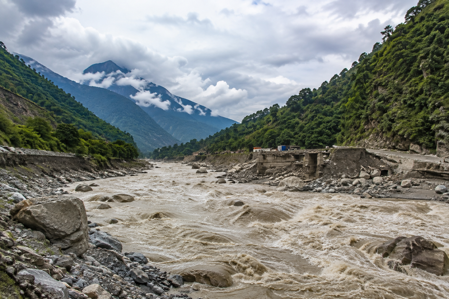
The level of damage became clearer as rescue teams reached the areas. In Rasuwa the flood swept through homes and buildings along the river. Roads and bridges were broken or destroyed buildings were washed away. Important structures like hydropower facilities were affected. The IFRC reported damage to homes, roads, bridges, hydropower facilities and other important places with several bridges gone and some areas in Rasuwa very hard to get to.
The destruction also reached downstream. ICIMOD reported damage to monitoring stations along the Trishuli River while the very quick rise in water levels worried people living farther down. The disaster therefore affected more than the immediate flood area. It caused problems with transportation, power, communication, trade and access for communities that rely on the river corridor.
Deaths, Missing People and the Current Situation
The number of people affected is still being worked out.
By August 27 international reports said than 1,000 people were missing across Nepal and Chinas Tibet area with Reuters later saying the total was close to 1,500. Nepal had said than 826 people were missing while Tibet authorities said 558 were missing. The number of confirmed deaths has also changed as bodies have been found and identified. Reuters said at 165 people had died in its August 27 report while other reports have had different numbers as rescue and recovery continue.
These numbers should be seen as changing, not final. The high number of people missing is because of the people in the area. The corridor is used by people, workers, traders and foreigners including pilgrims going to Mount Kailash and Lake Manasarovar. Reuters said foreign nationals from countries were among those missing. Because of this Nepals authorities and embassies are still checking names and places not just relying on reports.
From Tibet to Rasuwa: How the Flood Spread
Understanding the geography helps explain the size of the disaster.
The suspected cause happened in the Himalayan area on the Tibet/China side of the border. From there the sudden wave entered the river system connected to the Lhende Khola. The water and debris then reached the Rasuwagadhi border area in Nepal. Moved through the Rasuwa area, including Timure and Syabrubesi. From the Bhote Koshi system the flood continued toward the Trishuli River making the effects reach farther downstream. ICIMOD warned of impacts reaching Nuwakot and Dhading. Noted very fast changes in water levels. This is why the disaster cannot be seen as a Rasuwa flood. The river connected the high-mountain event to communities downstream.
Impact on the Nepal–China Border
The disaster has had an effect on the Nepal–China border area, especially around Rasuwagadhi and the area on the Tibetan side. Rasuwagadhi is more than a place. It is a border point for trade, transport and travel between Nepal and Tibet. Damage to roads, bridges, power systems and other things has affected both people and movement across the border.
On the side authorities reported serious damage around Gyirong County including broken structures and people being moved out of dangerous areas. Reuters said Chinese officials were also watching a lake because of the risk of another flood. The cross-border nature of the disaster means that cooperation between Nepal and China is very important for river monitoring, early warnings, search and rescue and handling possible extra dangers.
Rescue and Relief Operations
Search and rescue started away but broken roads, destroyed bridges, bad weather and difficult mountain area made it hard to get in. Nepal has used the Nepal Army, Nepal Police, Armed Police Force and disaster-management groups with helicopters being used to reach places that are cut off and search for missing people. Reuters said than 5,000 security workers were involved in the search and rescue and that more than 100 people had been saved by helicopter missions. The International Federation of Red Cross and Red Crescent Societies (IFRC) gave nearly CHF 1 million from its emergency fund to help the Nepal Red Cross Society with its work.
The money is meant to help provide help while teams check damage and find communities that need help. The United Nations has also said that humanitarian groups are helping the Nepal government. WHO teams have been sent with supplies while the World Food Programme, UNICEF and other groups are preparing or giving more help. On the side emergency and rescue teams have also been used and officials are checking the upstream area for more danger.
What Happens Next?
Finding missing people and helping those who survived are the important tasks right now. At the time authorities have to deal with a much longer recovery. Roads and bridges will need to be checked and fixed, electricity and communication systems restored damaged hydropower plants looked at and affected communities supported. There is also worry about flooding. ICIMOD has warned that if debris made a temporary blockage upstream, a sudden release of stored water could cause another flood. Officials and scientists are still watching the situation. This means that even though the main flood has passed the emergency is not over.
What Does This Tell Us About Himalayan Flood Risk?
The disaster has also brought attention to the changing risks in the Himalayan area. Glaciers, snow, frozen ground and mountain slopes are changing across the Hindu Kush Himalaya. These changes can affect the stability of high-altitude areas. However ICIMOD has said it is too early to say how much climate change played a role in this specific flood. That difference matters. A hotter climate can increase some glacier and mountain-related dangers. It would be wrong to say climate change alone caused this event. The disaster does however show the need for monitoring, more warning systems and more cooperation between countries that share Himalayan rivers.
Safety Advice for People in Nepal
Anyone near the river areas should follow what local authorities say and avoid going into damaged areas. Do not go near rivers to take pictures try to cross bridges or travel on roads that are closed. Water can rise quickly. Roads or bridge foundations might be broken underneath. Travelers should also check weather and river info. Nepals Department of Hydrology and Meteorology (DHM) gives live water data and flood info. It currently advises people to use its warning services when there is heavy weather. For tourists needing help the Nepal Tourism Boards Tourist Police helps in places, including Syafrubesi in Rasuwa.
What Does the Flood Mean for Trekking in Nepal?
The disaster should not be understood as meaning that every place for hiking in Nepal has been harmed in the way. The biggest problems are found near Rasuwa, the Nepal China border and the Bhote Koshi Trishuli area. However the situation is very important for people who want to do the Langtang Valley Trek because Syabrubesi is an entrance to the Langtang area. Any person planning to go through Rasuwa should look at the road and path conditions before they leave and be ready for changes in the route.
Other big places for hiking, such as Everest, Annapurna and Mardi Himal are away from the main area where the disaster happened. That does not get rid of the dangers from rainy season weather, landslides and road problems but people who are traveling should look at each place separately instead of thinking that conditions in Rasuwa are the same for all of Nepal.
Nepal Tourism Update: What Travelers Need to Know
The flood has clearly hurt tourism in the area that was directly hit. People from countries and those who were visiting for religious reasons were among those who were missing. The damage to roads and the border structures will make it hard to go through the Rasuwa area. For people who are thinking about visiting Nepal the problem is more about areas than the whole country. The best way is to look at the place and the road you are taking instead of just asking if Nepal is open. A person going to Rasuwa or the Nepal China border needs details than someone going to Pokhara, the Annapurna area or some other part of the country.
Before you travel check road conditions, transport times and hiking access with your airline, transport company, hotel, guide or local tour company. Travelers should also look at what their government says about traveling and make sure their insurance covers the activities they plan to do. At Best Trek & Adventure our advice is simple: safety and true information should come before any travel plans. If a path is broken or officials say not to go travelers should be ready to change or wait on that part of their trip.
Frequently Asked Questions
What caused the Nepal flash flood in August 2026?
Current scientific assessments point to a major ice-and-rock or glacial collapse in the high Himalayan region near the Nepal–China border. Scientists are still investigating the exact sequence that produced the sudden flood surge.
Which areas were most affected?
Rasuwa, particularly the Rasuwagadhi, Timure and Syabrubesi corridor, was among the worst affected. The flood then traveled through the Bhote Koshi and Trishuli river systems, with impacts farther downstream.
Did the flood affect China?
Yes. The event also caused major damage and casualties in Tibet’s Gyirong area and affected infrastructure on both sides of the Nepal–China border.
How many people died?
The confirmed death toll has been changing as rescue teams recover and identify victims. Reuters reported at least 165 deaths in its August 27 update. Because recovery operations are continuing, this should not be treated as the final toll.
How many people are missing?
The number is still being verified. Reuters reported nearly 1,500 people missing across Nepal and China’s Tibet region, including more than 700 foreign nationals.
Is Langtang Trek affected?
The Rasuwa access corridor has been seriously affected, so travelers planning the Langtang trek should check current road and trail conditions before departure.
Is Nepal safe for tourists?
The entire country is not uniformly affected by the flood. The greatest concern is travel through the directly affected Rasuwa, Bhote Koshi and downstream corridors. Conditions should be assessed destination by destination.
Can tourists still travel to Nepal?
Travel may still be possible in areas outside the affected corridors, but travelers should check current transportation, weather and local conditions before departure and remain flexible about their itinerary.
Latest Update — August 27, 2026
The search for missing people and the checking of damage are still happening after the flood on August 26. The recent international news says that the disaster has hurt both Nepal and Tibet in China with many deaths and a very big number of people still missing. Teams are still. Officials are watching for more floods from unstable piles and blocked rivers. Scientists are also still looking at how the ice and rock fall up in the mountains turned into such a big flood. ICIMODs current thinking is that an ice and rock fall is the start but the exact reason is still being looked into.
This article will be updated as verified information from authorities, scientists and humanitarian organizations becomes available.
Sources & Official Information
This article has been prepared using information from Nepalese and international authorities, scientific organizations, humanitarian agencies and established international news reporting. Because this is a developing disaster, readers should check the latest updates directly from these organizations:
- National Disaster Risk Reduction and Management Authority (NDRRMA) — Nepal’s national disaster-risk management authority.
- Department of Hydrology and Meteorology (DHM), Government of Nepal — Flood monitoring, river levels and weather information.
- Nepal Tourism Board — Tourism information and traveler assistance.
- ICIMOD — Scientific information on the Himalayan environment and current flood assessment.
- International Federation of Red Cross and Red Crescent Societies (IFRC) — Humanitarian response and emergency assistance.
- United Nations — International humanitarian response and updates.
- Reuters — Independent international reporting used to cross-check developing information.